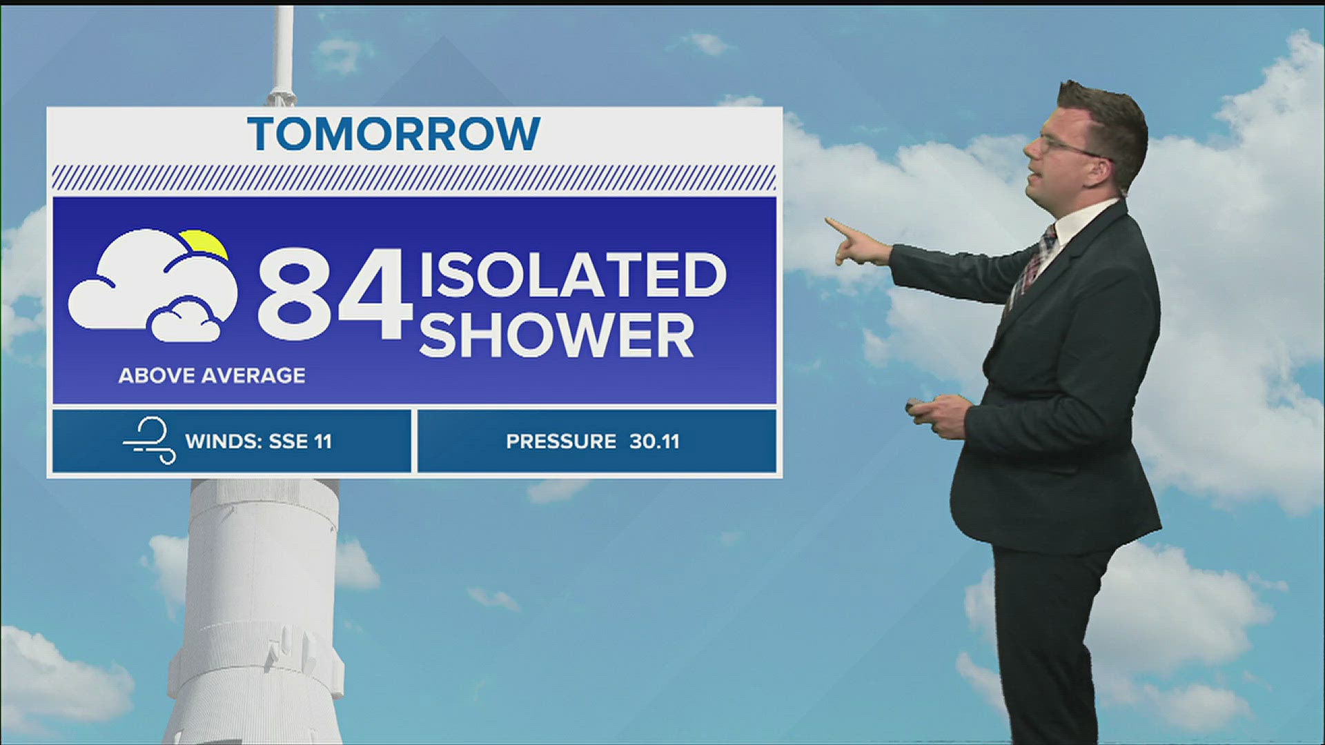
HUNTSVILLE, Ala. — Another afternoon of scattered showers and thunderstorms across the Tennessee Valley. The chance will stick around through the evening and the early part of the overnight.
Little change in our weather pattern means showers and storms are possible once again on Friday. We continue to watch an area of low pressure that has been slowly moving east over the last several days. It looks like it'll finally move through the Tennessee Valley on Friday. Again, this doesn't change our forecast much with showers and thunderstorms sticking around.
Just like today and much of the week, thunderstorms could be strong or marginally severe. The biggest threats would be very heavy rain and gusty winds. If storms are able to develop enough, some small hail could also be possible.

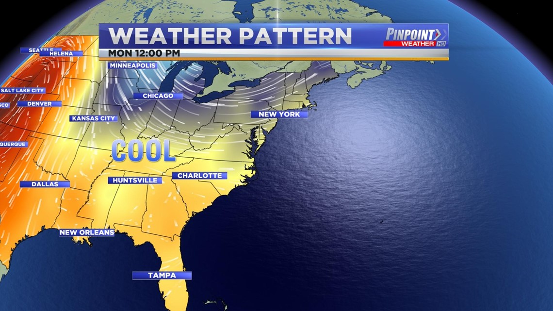
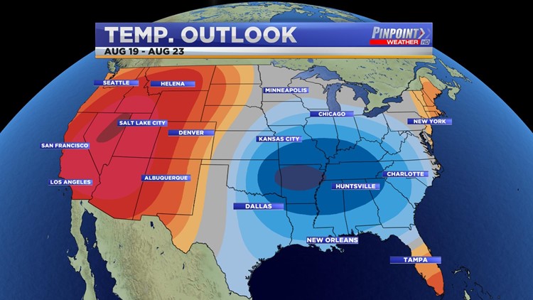
All of this is ahead of a pretty big change in our weather pattern. This change involves a developing ridge across the western United States and a developing trough across the eastern United States. We'll begin to realize these changes Sunday - Wednesday of next week.
These changes bring a lot of good to the Tennessee Valley. It looks like dew points will back off and temperatures will fall below-average much of next week. With a lack of moisture we'd be looking at smaller opportunities for rain as well.


Below-average temperatures are forecast to stick with us through the forecast period towards the end of August. The CPC is putting us at a 60% of seeing below-average temperatures through August 23rd.
This is NOT an early start to Fall, rather a stretch of cooler days in August. Remember this is the Tennessee Valley and we still have to get through September.