
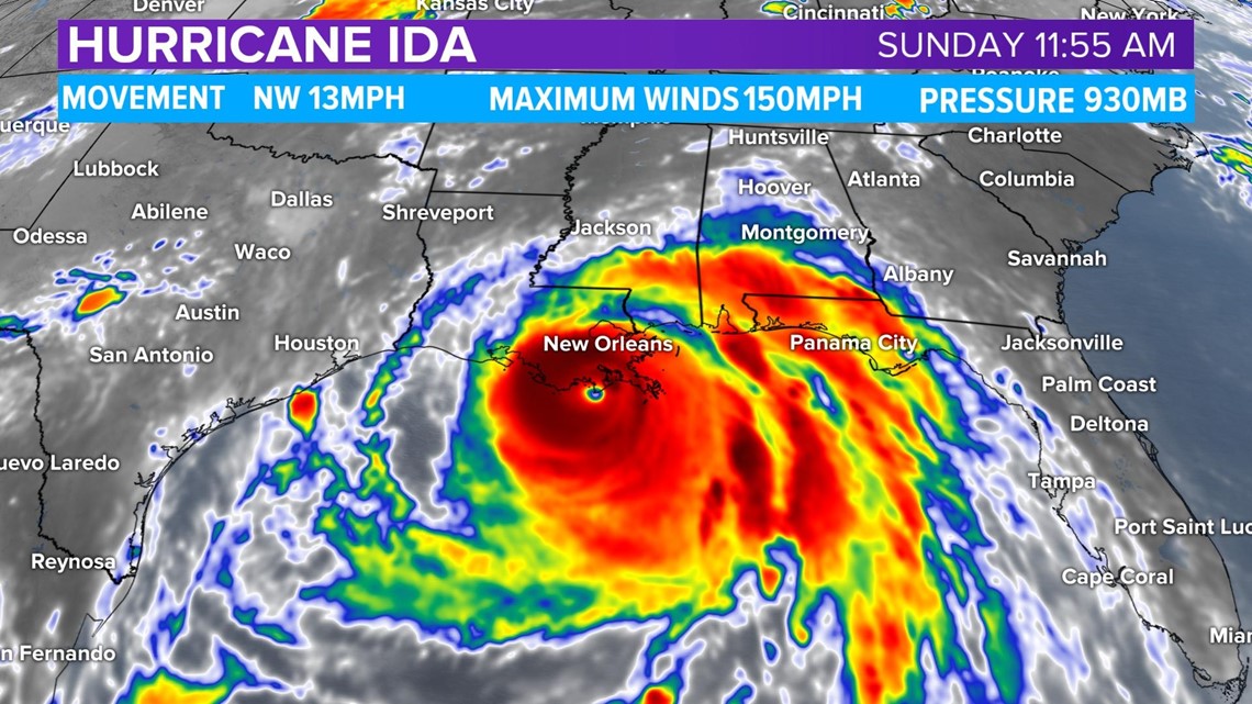
HUNTSVILLE, Ala. — At 11:55 AM Sunday, Hurricane Ida made landfall over Port Fourchon, LA as a major, category four hurricane with maximum sustained winds of 150 MPH with wind gusts recorded near 153 MPH.

Alabama Governor Kay Ivey issued a State of Emergency ahead of the storm.
Extremely life-threatening storm surge of 9 feet or greater above ground level is imminent somewhere within the area from Burns Point, Louisiana, to Ocean Springs, Mississippi. Overtopping of local levees outside of the Hurricane and Storm Damage Risk Reduction System is possible where local flooding values may be higher.
Catastrophic wind damage is likely where the core of Ida moves onshore along the southeast coast of Louisiana in the next few hours. Hurricane-force winds are expected today within the Hurricane Warning area along the Louisiana coast, including metropolitan New Orleans.

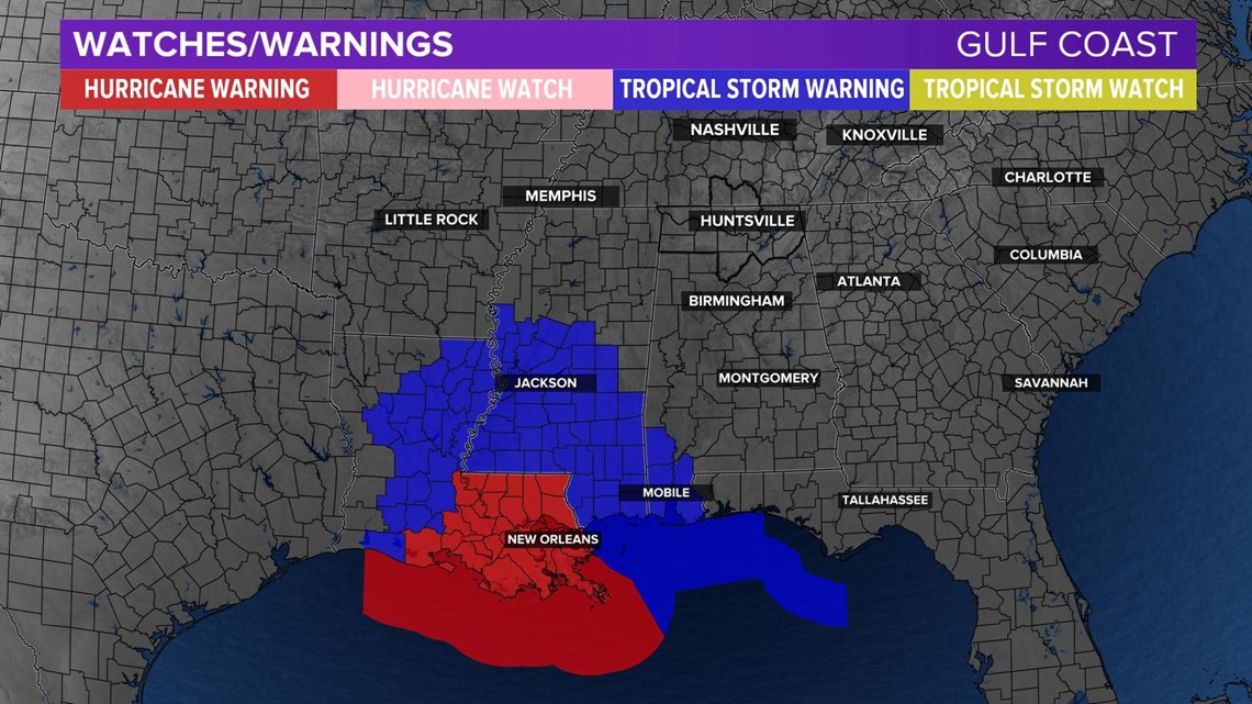
Damaging winds, especially in gusts, will spread inland near the track of the center of Ida across portions of southeastern Louisiana and southwestern Mississippi Sunday night and early Monday. These winds will likely lead to widespread tree damage and power outages.
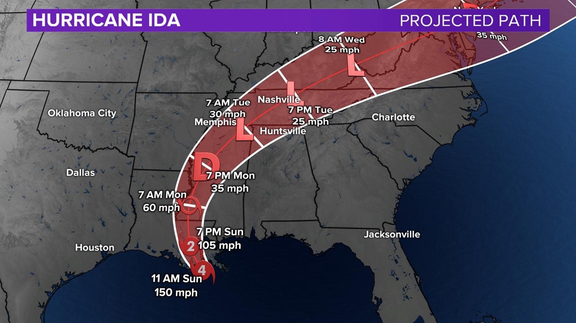
Ida will produce heavy rainfall today through Monday across the central Gulf Coast from southeastern Louisiana, coastal Mississippi, to far southwestern Alabama resulting in considerable to life-threatening flash and urban flooding and significant river flooding impacts. As Ida moves inland, significant flooding impacts are possible across portions of the Lower Mississippi, Tennessee, and Ohio Valleys through Wednesday.
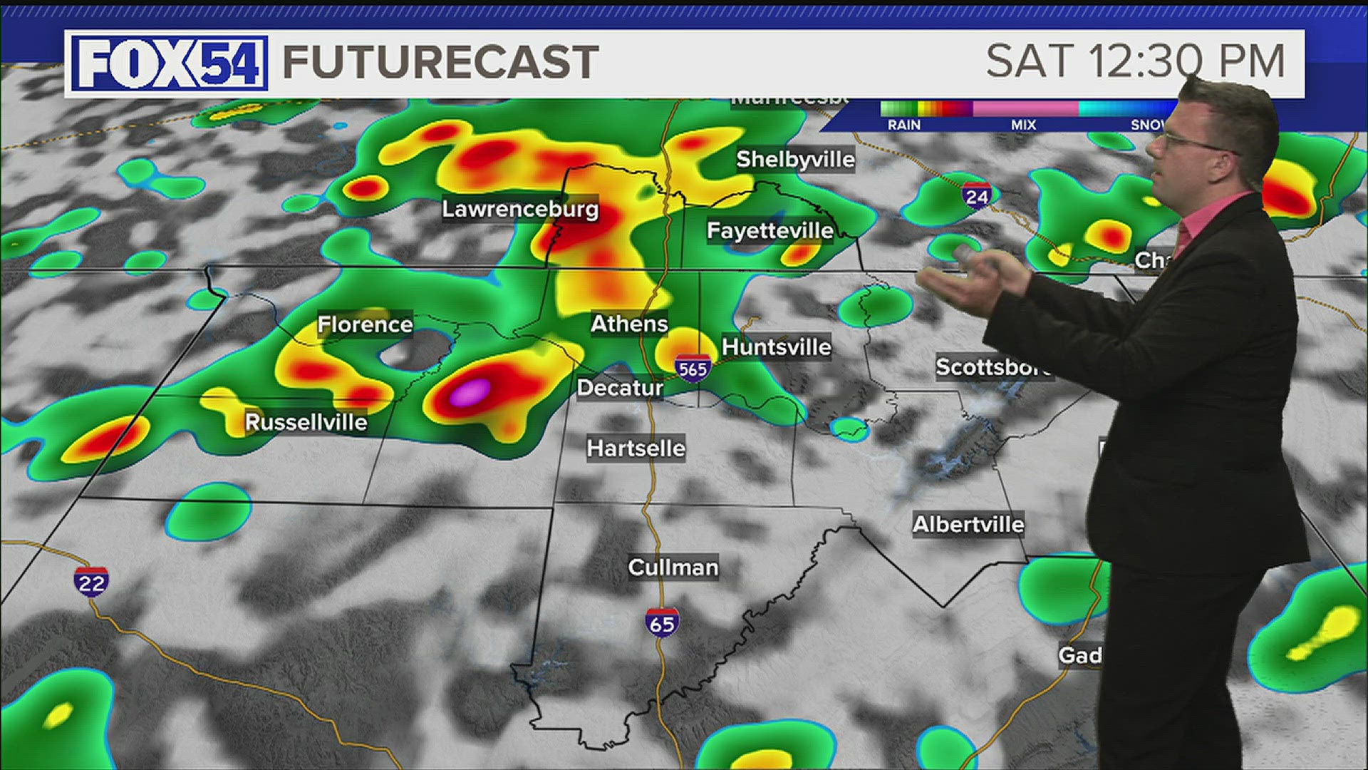
Ida Impacts in the Tennessee Valley

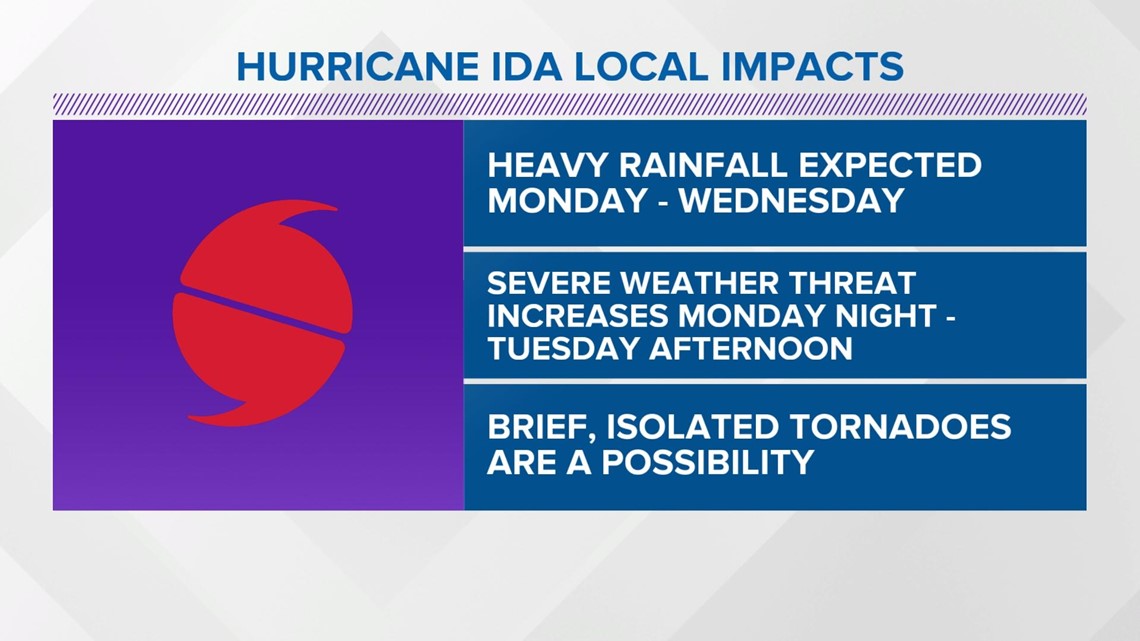
As for us here in the Tennessee Valley, heavy rainfall is expected Monday through Wednesday, especially over northwest Alabama. Flash flooding will be possible. Rises on rivers, creeks, and streams will also be possible. The threat for severe weather, including the possibility for brief, isolated tornadoes, will increase Monday night into Tuesday afternoon. Not only will we be dealing with a flood and tornado threat, damaging wind gusts will also be a possibility. Trees and powerlines will be easy to fall as our soils will already be saturated.