
HUNTSVILLE, Ala. — With ample sunshine this afternoon temperatures were able to meet or come very close to meeting seasonal norms. With a few clouds tonight, we'll be cold but we will not be as cold as we have been the last few nights across the Tennessee Valley. Temperatures will fall into the low 30s with the traditionally cool spots falling into the upper 20s.
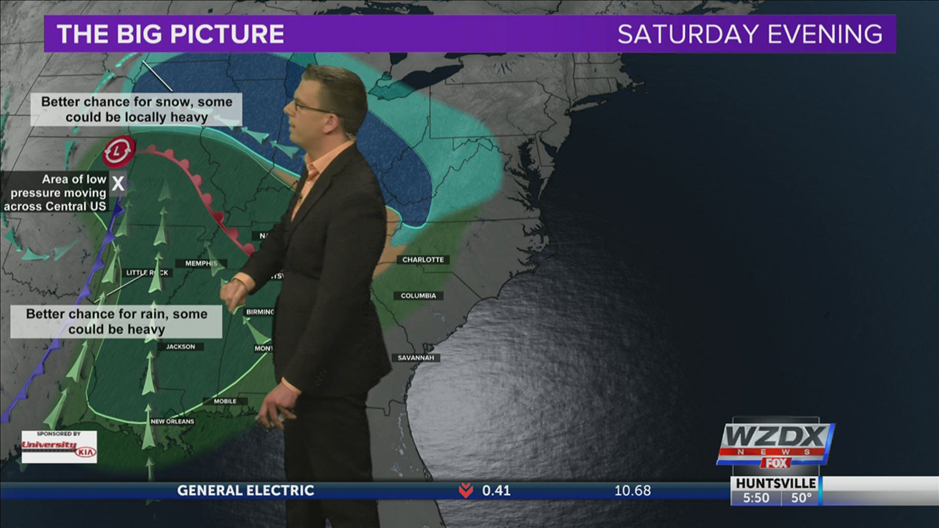
An area of low pressure will continue to push east eventually working into the Ohio Valley. This low pressure comes with an attendant cold front and our next opportunity for rain in the Tennessee Valley. It will also bring quite a bit of snow to portions of the Midwest.
As this system approaches, our winds will increase and become more southerly. Those southerly winds will usher in more moisture leading to a mostly cloudy day and warmer air which leads to a day with temperatures in the low and mid-50s despite that just mentioned cloud cover.

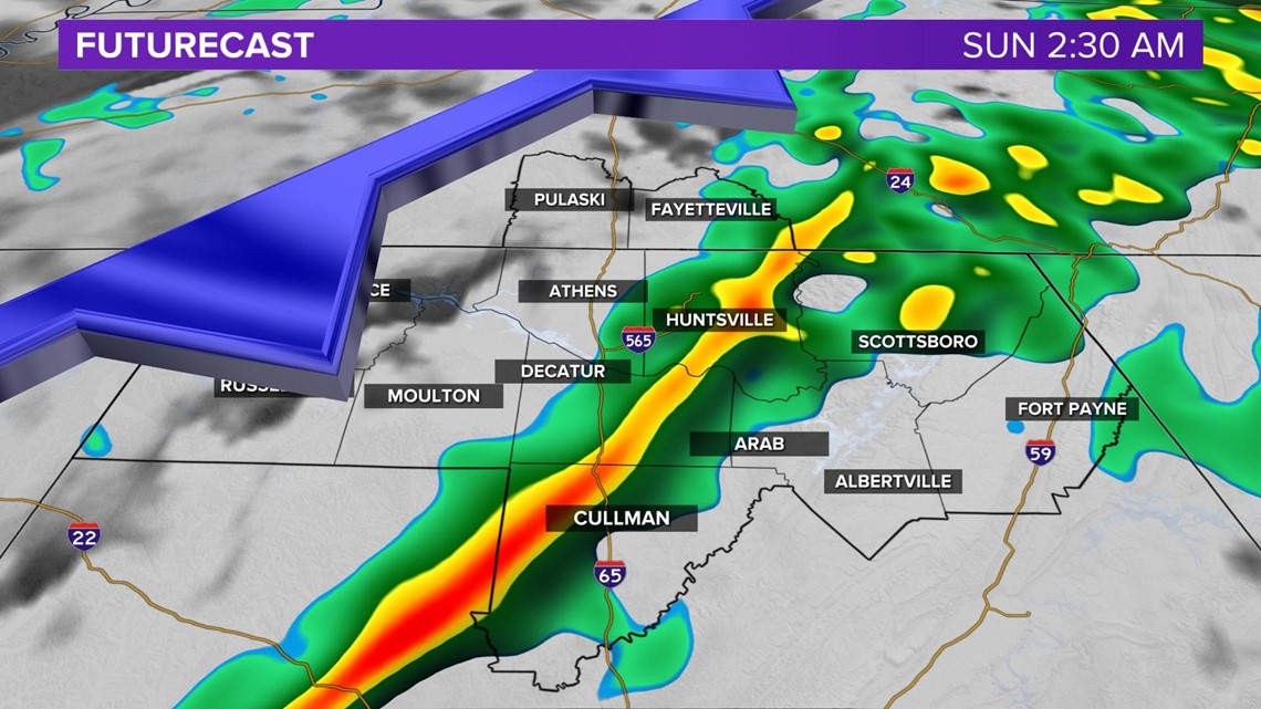
Scattered showers will move into the Tennessee Valley Saturday evening, but this activity will become more widespread overnight and early Sunday morning. This is when we expect the cold front to move through. At this time we expect some breezy conditions near windy and some potentially heavy rain. The atmospheric conditions are not there to support any thunderstorms.


Rain totals will not be overly impressive with many looking at less than a half an inch. Locally we'd be looking at about half an inch on the higher end of the spectrum.

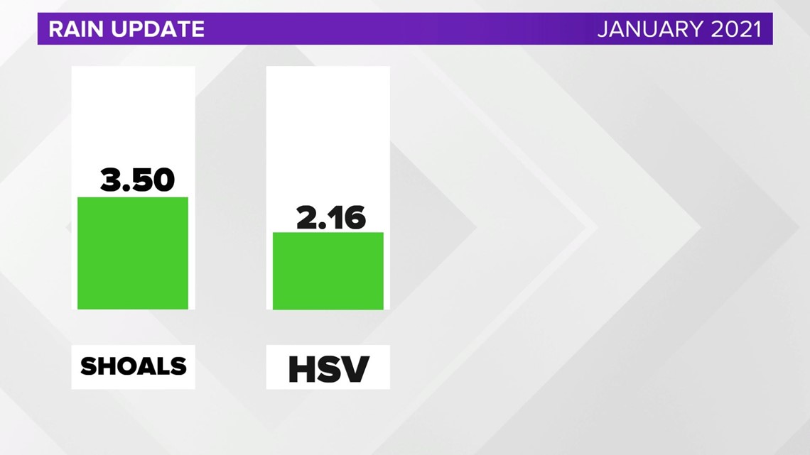
We could actually use the rain in the Tennessee Valley. Muscle Shoals Airport has only seen 3.50 inches and Huntsville International Airport has seen just 2.16 inches.