

HUNTSVILLE, Ala. — The weekend was beautiful and this afternoon really wasn't that bad either. While it was cloudy this afternoon we managed to warm into the upper 60s across the majority of the Tennessee Valley.
This all changes tonight thanks to a system currently sitting to our NW. This entire system will begin to move NE and bring showers and even a few thunderstorms into the Tennessee Valley tonight and through the first half of Tuesday morning.
By the lunch hour, a lot of this activity will come to an end. A few scattered showers remain possible through the afternoon, but overall much of Tuesday actually looks dry.

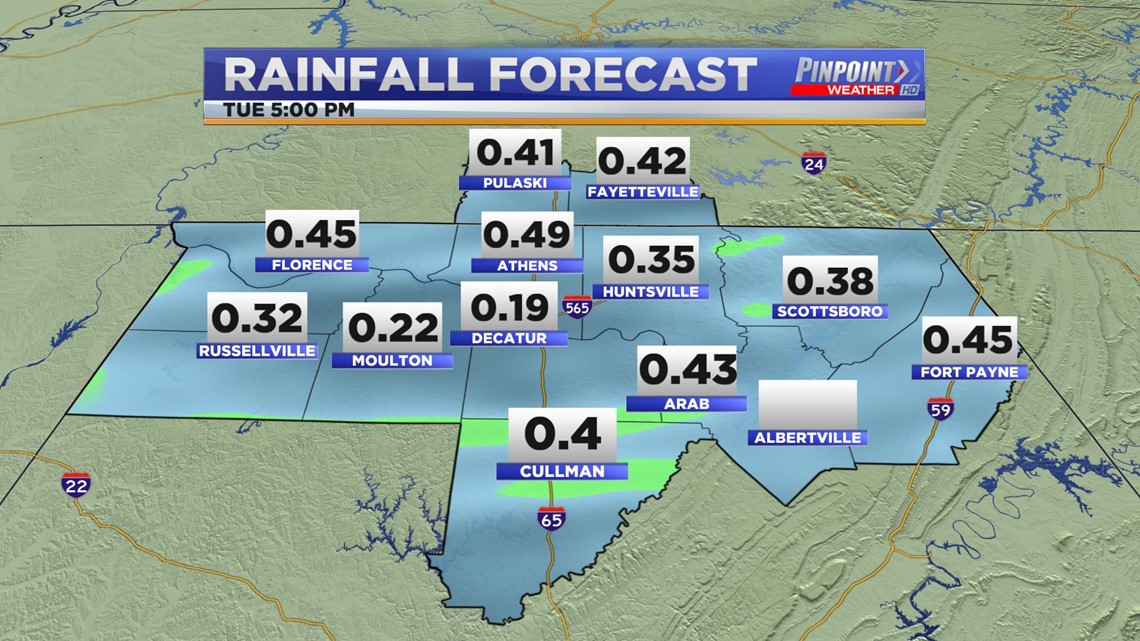
Rain totals for much of the Tennessee Valley will remain below 0.50".

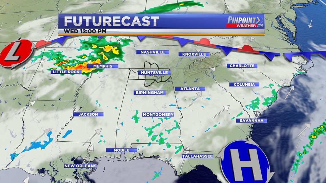
The dry conditions Tuesday afternoon will be short-lived as yet another system approaches by the time we hit the afternoon Wednesday. Depending on our abilities to destabilize this round of showers and thunderstorms could be a little stronger producing some gusty winds and hail.
As it stands right now it looks like there is a slightly better environment conducive for severe weather back to our west.

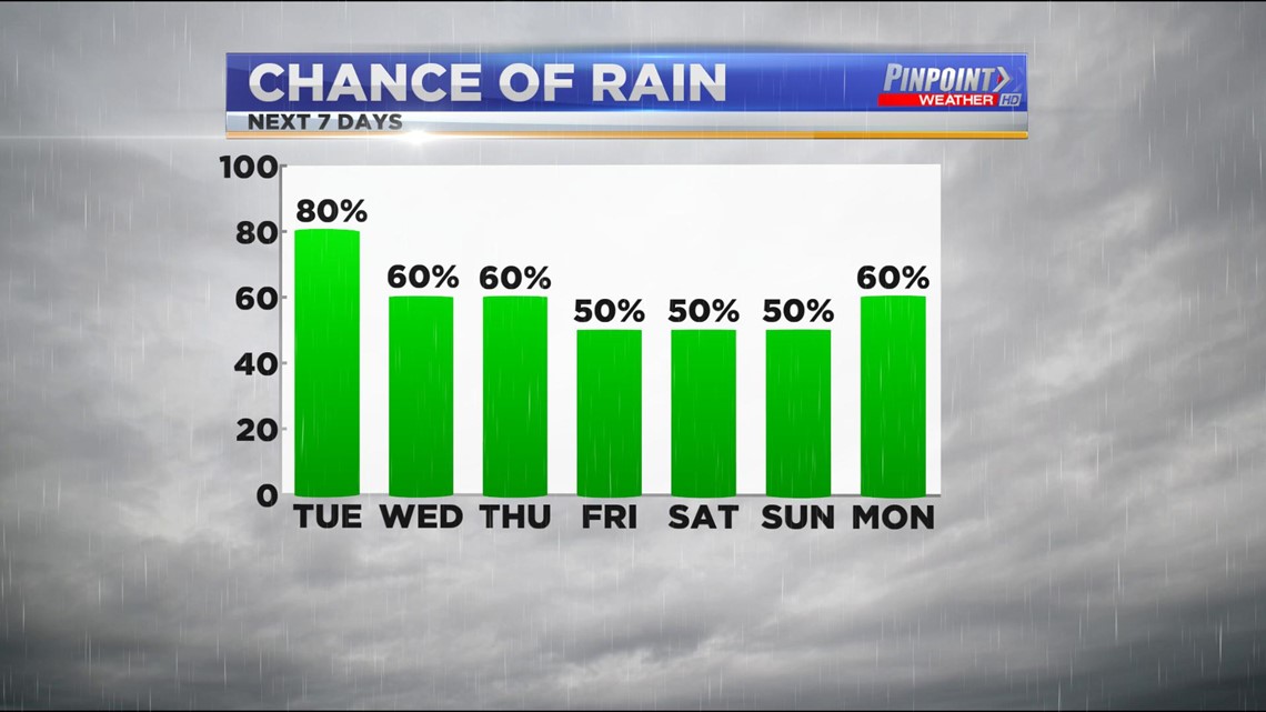
Unfortunately even the above isn't the only rain we're expecting this week. This is a chance of scattered showers every single day this week.