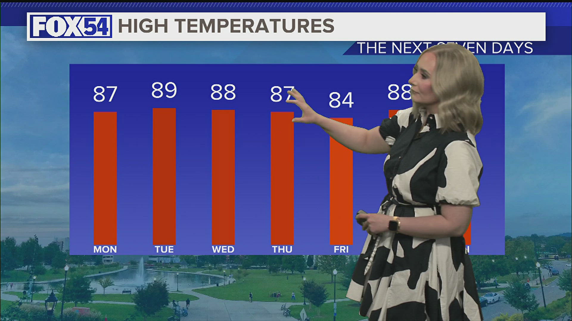
HUNTSVILLE, Ala. — Another day of being influenced by that area of low pressure that has played a huge role in our forecast the last several days. We saw a few showers this afternoon especially across Southern Middle Tennessee, but as these showers moved south they fell apart.
A couple of showers will remain possible through the evening, but generally we'll remain dry. The aforementioned low will continue to move north and weaken Friday afternoon. While it will move further from the Tennessee Valley it will still have some role in our forecast.
Just like the last few days it will still bring afternoon cloud cover with the opportunity for a few showers.
While all that is going on a ridge will begin to develop across the SE and move into the Tennessee Valley this weekend.


This will bring a change in our wind direction. Instead of being northerly, we'll now have winds out of the south. This will bring in warmer and more moist air into the Tennessee Valley. expect dew points to climb into the upper 60s near 70°.


A pattern change comes at a rather opportune time. This Saturday is the first day of Summer. It comes a day early this year thanks to the leap year. Summer officially starts at 4:44 PM on Saturday.


It's a busy weekend in the Tennessee Valley! Saturday is the first day of Summer and Sunday is Father's Day! It'll be warm for sure this weekend, with small opportunities for rain.