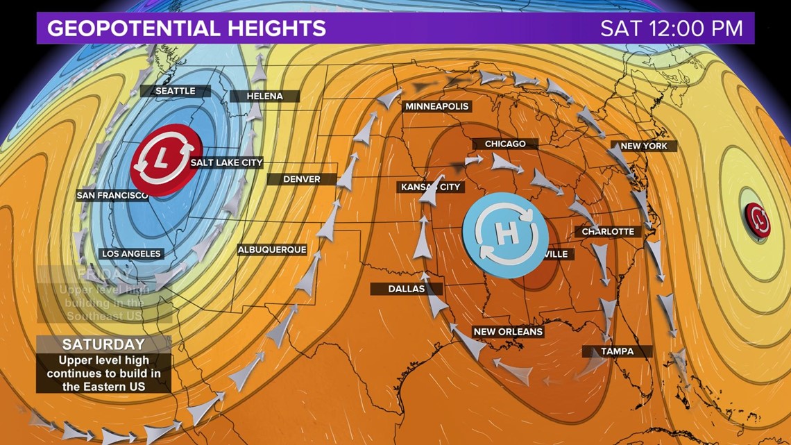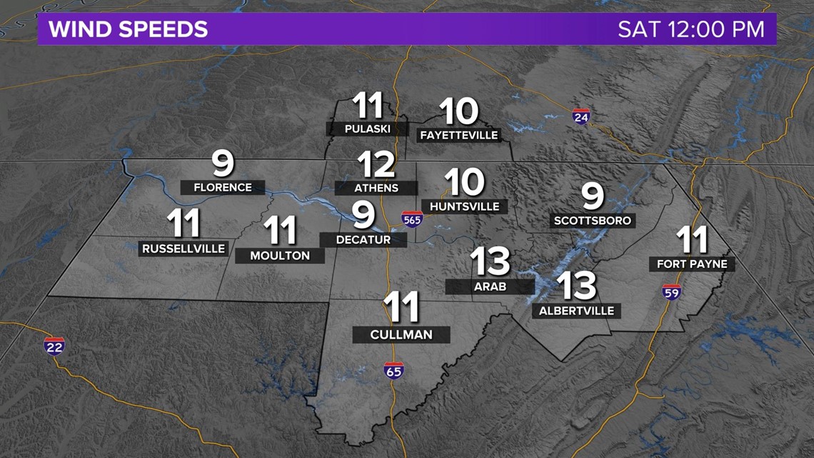
HUNTSVILLE, Ala. — Sustained wind speeds and wind gusts have been slightly elevated the past few days. Today's wind speeds peaked into the 20 mph range today and that's all thanks to how we're placed right now between a low pressure system that's off to our west (which might I add is bringing SNOW to some areas) and a high pressure system that's pretty much over the state of Alabama.
When you have a low pressure system, winds will rotate counter-clockwise around the low. Winds will typically come out of the north/northwest when we see low pressure systems. When you have a high pressure system, winds will rotate clockwise around the high. Winds will typically come out of the south/southeast when we see high pressure systems.
The change in pressure measured across a given distance is called a pressure gradient (AKA the distance between the high and low pressure systems). The pressure gradient results in a net force that is directed from high to low pressure and this force is called the pressure gradient force (PGF). The pressure gradient force is represented by the lines below, which is the pattern of the jetstream.
The closer together these lines get, the tighter the PGF gets, which results in higher wind speeds.
By the weekend, the high pressure system we're currently sitting under will have moved it's way more westward and northward, which will decrease the PGF here and decrease the wind speeds. We'll still see a nice breeze, which will probably feel good considering we're hitting the 90s this weekend!