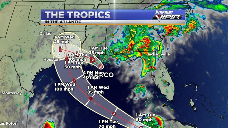

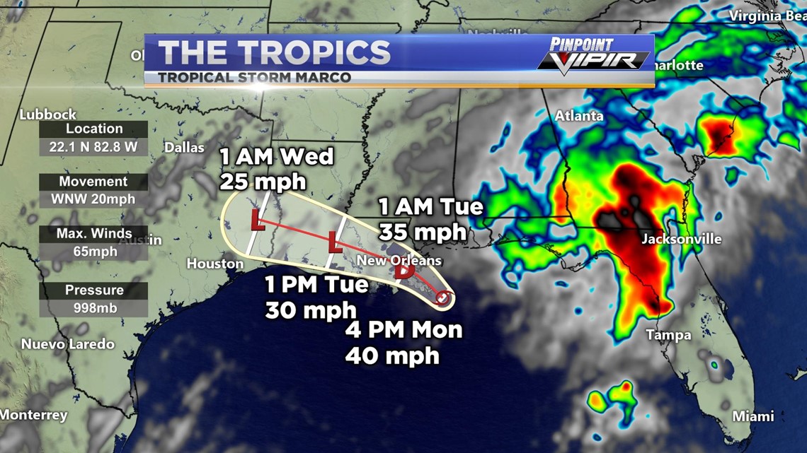
HUNTSVILLE, Ala. — As of 6 PM CST, Tropical Storm Marco made landfall near the mouth of the Mississippi River. Marco will continue to bring wind gusts and heavy rainfall as it continues to dissipate westward towards Texas, becoming a low-pressure system by tomorrow.

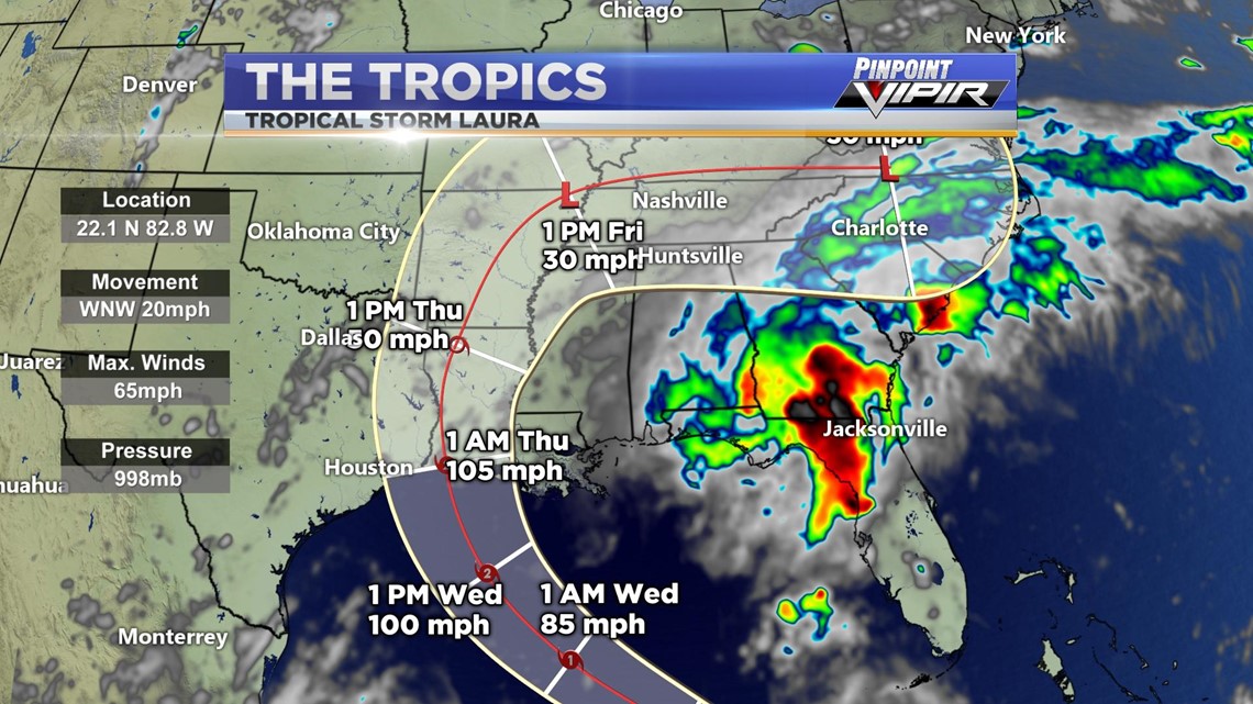
Now that Marco has made landfall, we only have one storm to keep our focus on that could potentially develop into a major category three hurricane before making landfall on late Wednesday night/early Thursday morning.
Tropical Storm conditions and heavy rainfall are expected across central and western Cuba through tonight. These rains could cause mudslides and life-threatening flash and urban flooding. There is a risk of life-threatening storm surge from San Luis Pass, Texas to Ocean Springs, Mississippi, within the next 48 hours, and a storm surge watch has been issued for these areas outside of the southeastern Louisiana Hurricane and Storm Damage Risk Reduction System.
RELATED: 2020 Hurricane Season Looks Extreme
Hurricane conditions are possible late Wednesday from Port Bolivar, Texas to west of Morgan City, Louisiana, with tropical storm conditions possible by Wednesday afternoon, and a hurricane watch has been issued. Additional hurricane watches may be needed farther south along the Texas coast if the track forecast shifts toward the south along the Texas coast if the track forecast shifts toward the south and west tonight and Tuesday.
Tropical Storm Laura is expected to upgrade to a Category One hurricane by early Wednesday morning and is expected to continue to strengthen into a Category Two hurricane before making landfall. Laura will eventually start tracking to the east, bringing increasing rain chances to the Tennessee Valley at the end of this week.