HUNTSVILLE, Ala. — This year’s hurricane season is expected to be another above average one. The 2020 Atlantic Hurricane Season, which marked the fifth consecutive year of above average activity, was the most active and the fifth costliest Atlantic hurricane season on record. The 2020 season also had the highest accumulated cyclone energy (ACE) since 2017, and the tenth highest record, tied with 1998.
The 2020 Atlantic Hurricane Season featured a total of 31 subtropical cyclones, all but one of which became a named storm. Of the 30 named storms, 13 developed into hurricanes, and six further intensified into major hurricanes with one, Hurricane Iota, attaining Category 5 status. It was the second and final season to use the Greek letter storm naming system, with the first being 2005. Of the 30 named storms, 11 of them made landfall in the contiguous United States, breaking the record of nine set back in 1916.
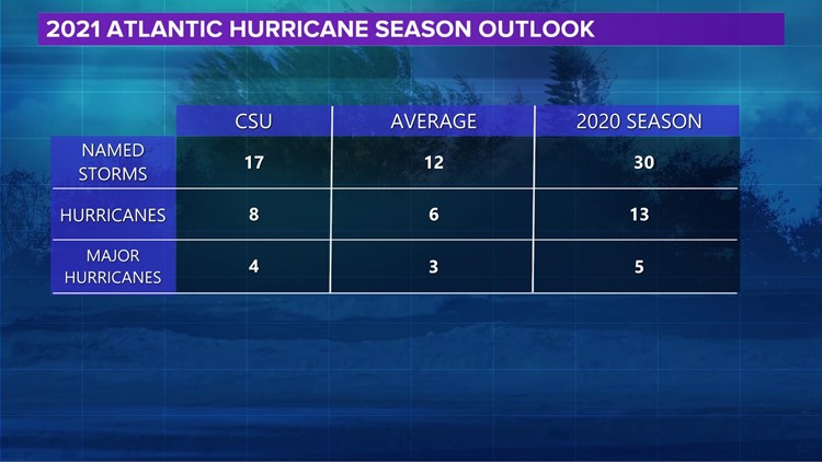
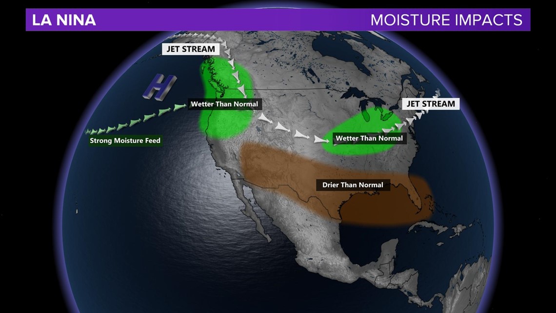
Colorado State University is predicting another year of above normal tropical activity in the Atlantic Basin. Dr. Philip Klotzbach and the research team cited an absence of El Niño and the potential for weak La Niña conditions to continue through the summer and fall seasons.

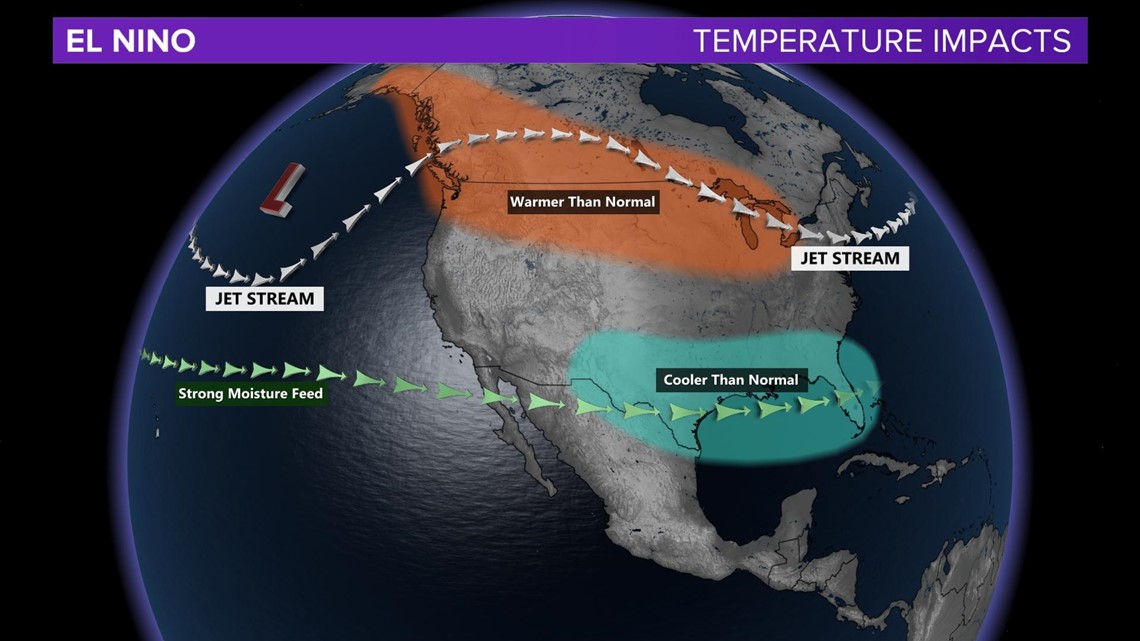

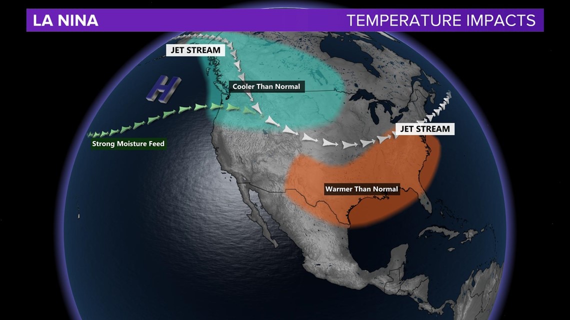

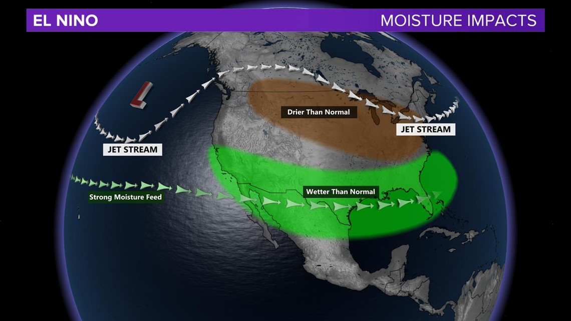

As defined by the National Oceanic and Atmospheric Administration (NOAA), El Niño and La Niña are the warm and cool phases of a recurring climate pattern across the tropical Pacific – the El Niño-Southern Oscillation, or ENSO for short. Keep in mind that El Niño and La Niña do not cause any one specific weather event; rather the two phases of ENSO influence change in global climate pattern that then increase the likelihood of specific weather events.
La Niña is a pattern which favors much more activity in the Atlantic Basin during hurricane season. During La Niña, the trade winds weaken over the Atlantic Ocean creating a more supportive environment for tropical cyclone formation. Warm sea surface temperatures enhance evaporation and cloud development. In the presence of favorable winds, heat energy from the ocean promotes tropical cyclone strengthening.
The experts at Colorado State University anticipate a nearly 70% chance of a major hurricane (Category 3 +) landfall in the continental United States.


The forecast is based on an extended-range early April statistical prediction scheme that was developed using 38 years of past data. These seasonal forecasts were originally developed by the late Dr. William Gray, who was lead author on these predictions for over 20 years. He continued as a co-author until his death in 2018.
You can review the entire prediction, the scientific explanation, and the reason such a forecast is made here. Seasonal updates are issued on June 1 and August 3. The researchers at Colorado State University and the WZDX Weather Team remind you that “it only takes one hurricane making landfall to make it an active hurricane season for you”, so prepare accordingly. NOAA’s official outlook is expected in late May.