
There currently sits a large area of low pressure over the Great Plains and Upper Midwest with an associated cold front. That system is currently bringing heavy snow to the upper Midwest and thunderstorms to portions of the southeast.

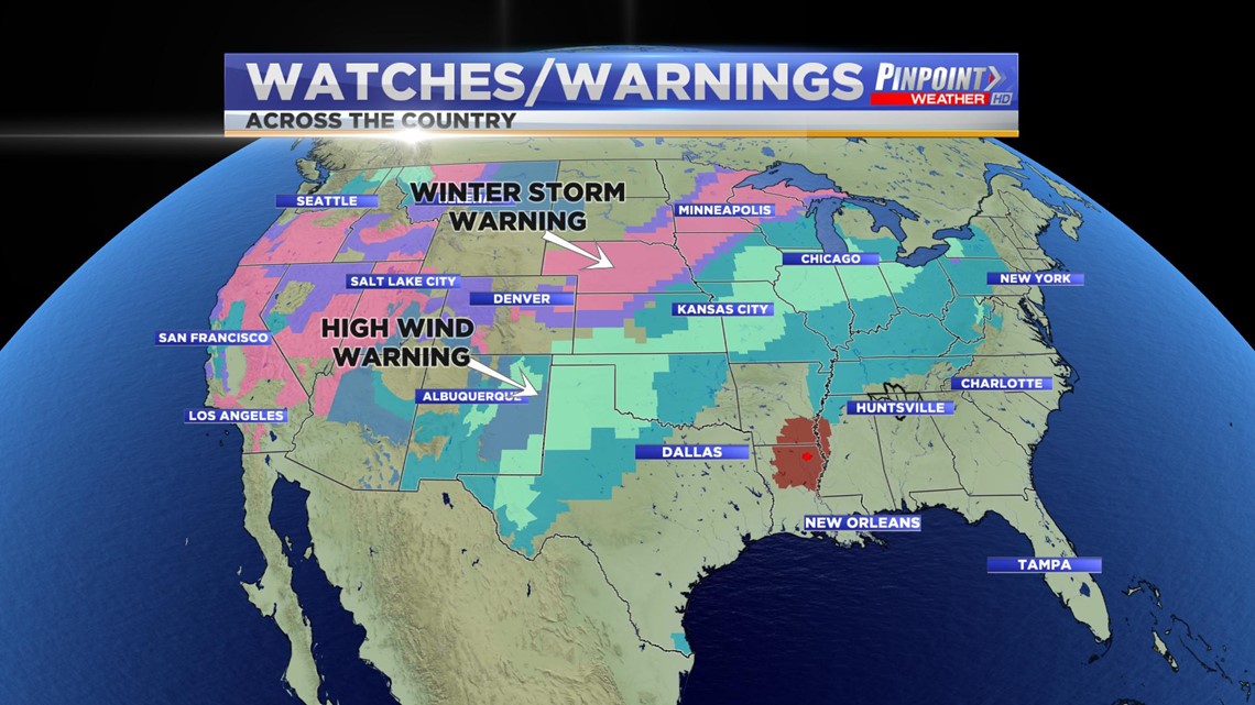
That is prompting everything from Winter Storm Warnings to High Wind Warnings across a significant portion of the continental United States.
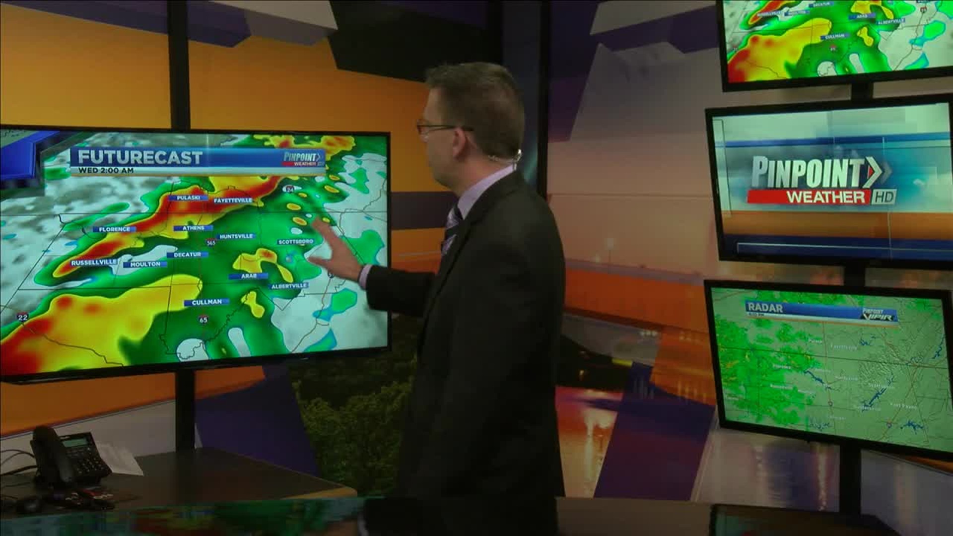
Those thunderstorms look to move through the Tennessee Valley overnight tonight and very early Wednesday morning. The latest run of the model suggests that storms could enter NW Alabama around midnight and exit NE Alabama just after 4:00 AM. Some storms could be stronger with the biggest threat being gusty winds in excess of 60 mph.
From there temperatures do look like they will fall during the day so expect it to get progressively colder Wednesday afternoon.


Heavy rain is also possible with most seeing at least 0.50″ by Wednesday afternoon.
Thanksgiving
After this latest round of active weather, a sub-tropical ridge will set up keeping us dry and quiet for the Thanksgiving holiday. If you’re traveling on Thanksgiving, I do not foresee any issues.

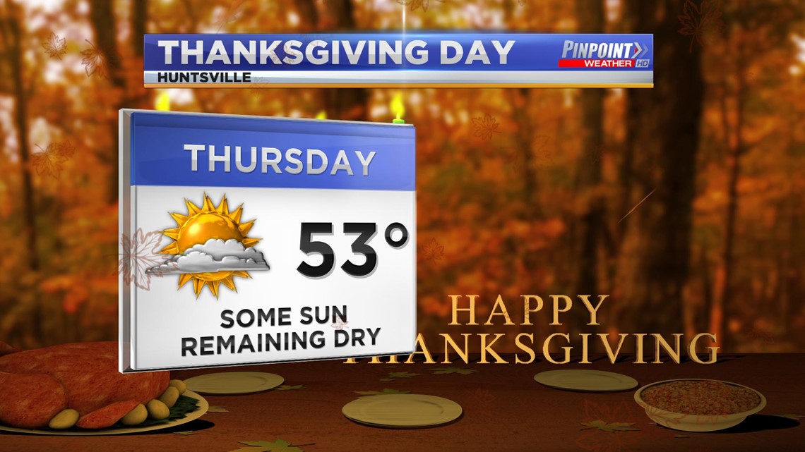
Overall, while chilly Thanksgiving should be pleasant.