HUNTSVILLE, Ala. — Another afternoon of showers and thunderstorms across the Tennessee Valley. Some of these storms have been on the stronger end of the spectrum with some gusty and even damaging winds. This activity will continue through much of the day Wednesday as well.
This activity is the result of a couple different players. First winds out of the south bringing in ample moisture. Second and more importantly is a stalled out boundary sitting to the north. This acts as a forcing mechanism for showers and thunderstorms to develop.
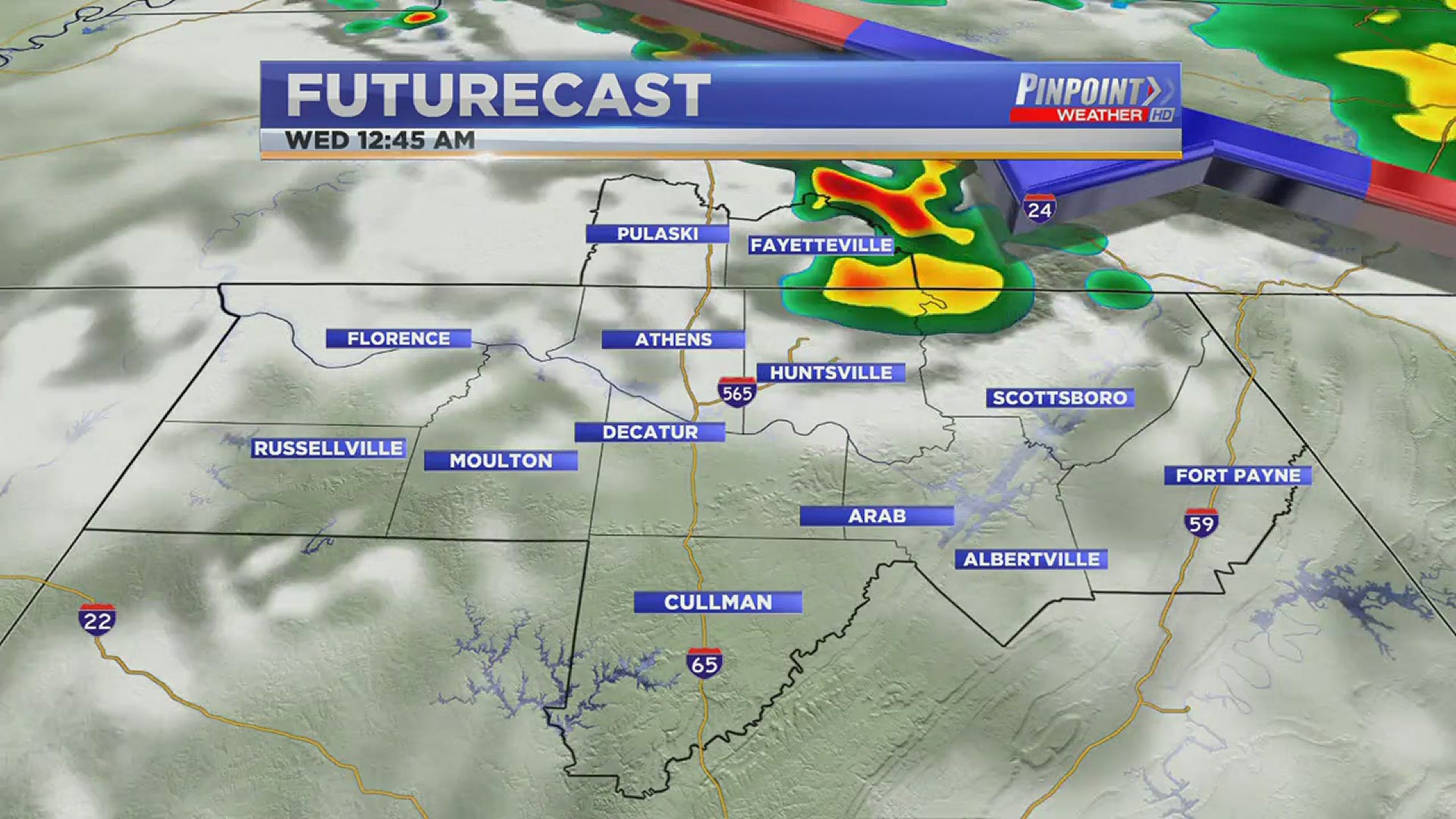
Showers and thunderstorms will remain possible all day Wednesday and once again some storms could be strong or marginally severe. Biggest threat there will be very heavy rain and some gusty winds. Current model runs are showing some more widespread activity Wednesday afternoon.
This system will sag further south on Thursday which could limit how widespread this activity is compared to what we expect on Wednesday.

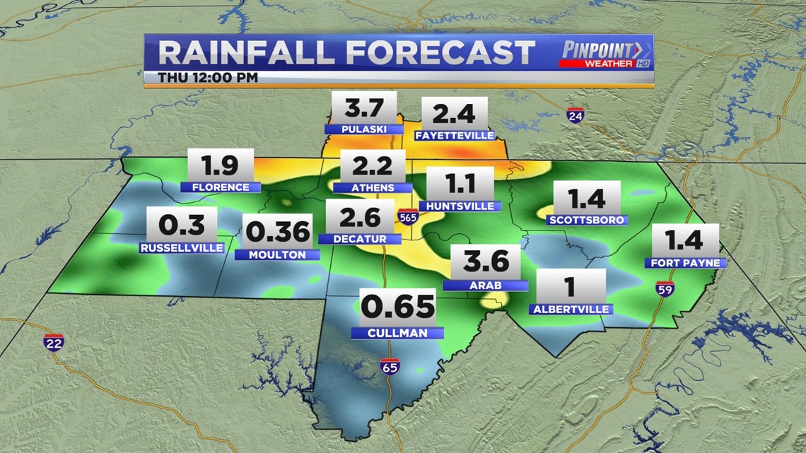
Rain totals through noon on Thursday could be higher in some locations. The highest rain totals will be more localized. With that in mind, parts of the Tennessee Valley could easily get a couple of inches of rain in the next 24-36 hours.

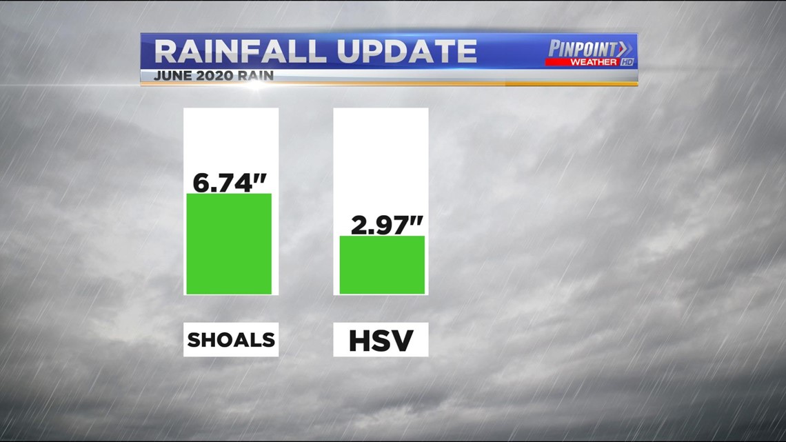
Some of us could use this rain. Huntsville International as only seen around 3.0" of rain in the month of June. The Shoals have seen more rain at almost 7".