
HUNTSVILLE, Ala. — A beautiful afternoon across the Tennessee Valley with everyone finishing the day in the mid and upper 50s under abundant sunshine. We'll see some changes as we approach the overnight where more clouds will build into the Tennessee Valley ahead of a rather weak cold front.
The cold front has the opportunity to bring a couple of very light showers Tuesday morning, but odds are we'll end up staying dry. Despite being on the other side of a cold front, surface winds will remain southerly allowing temperatures to climb into the upper 50s and low 60s Tuesday afternoon. An average high temperature is 54-degrees.
We'll be even warmer on Wednesday where the warmer spots in the Tennessee Valley make a pretty solid run at 70-degrees. They should fall short.

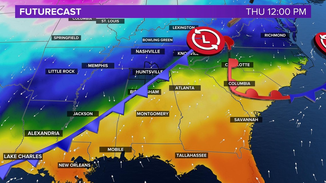
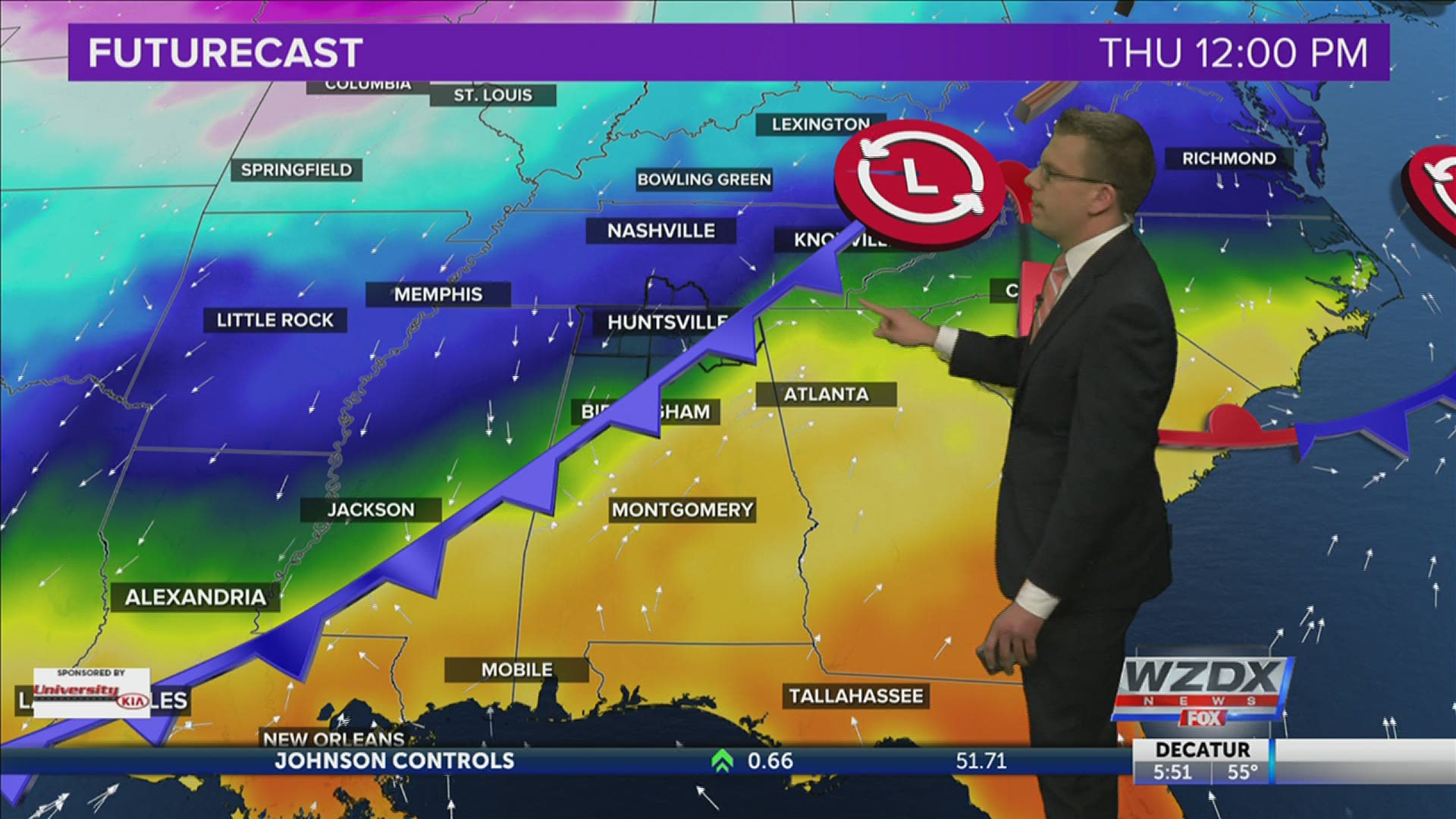
Now when we get to Thursday we begin to see some changes. A cold front will move through the Tennessee Valley bring both colder air and rain. How cold we get is still strongly up for debate. Models refuse to even agree a little on how far south this mass of cold air drops.

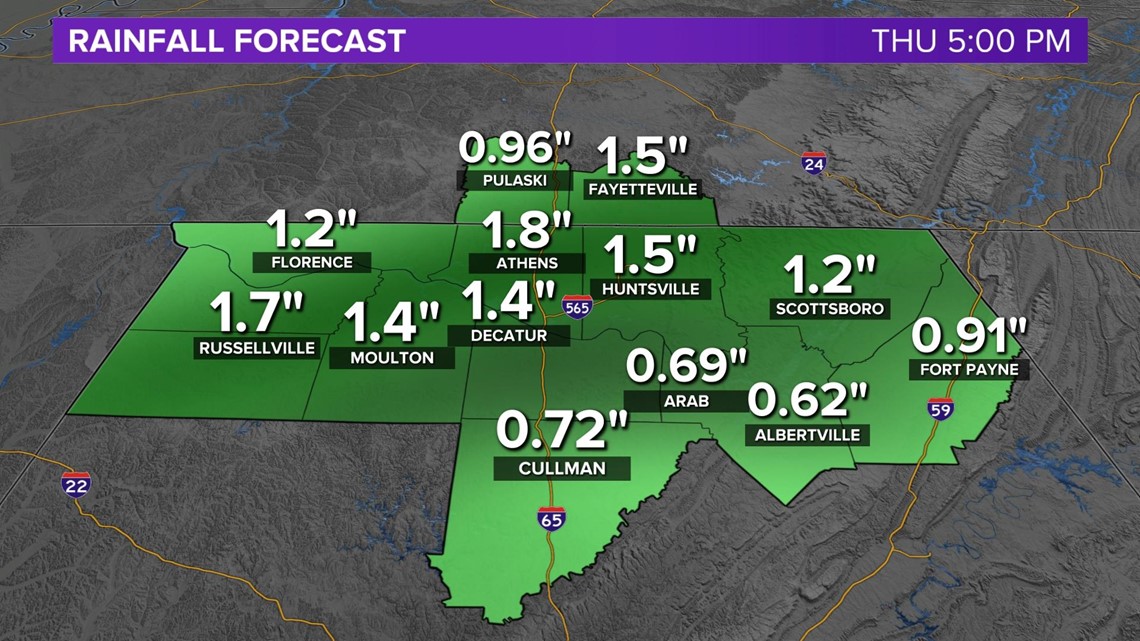
The rain the cold front brings actually looks significant and is much needed. Many will be looking at somewhere between 1.0" and 1.5" of new rain by Thursday evening.