
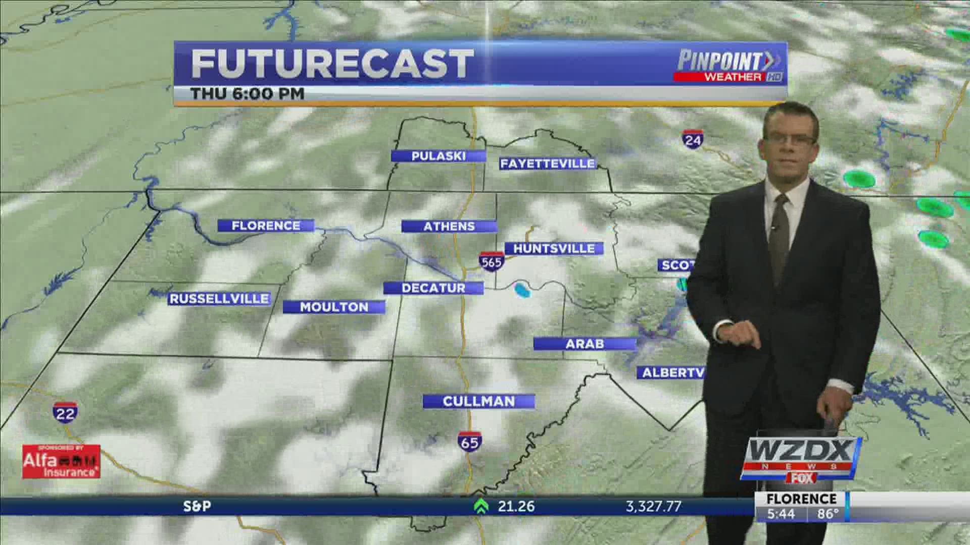
HUNTSVILLE, Ala. — A cold front moved through the Tennessee Valley Tuesday afternoon bringing scattered showers and thunderstorms. That cold front has stalled to our east and has no plans of moving through Thursday afternoon. This means the rain will stay in the forecast for some Thursday and Friday afternoon.
Those with the better chance of rain will be east of I-65. The best chance comes across far northeast Alabama. While some in Madison and Morgan Counties may get a few showers, those in Jackson, DeKalb, and Marshall Counties have the best chance for a bit of rain. Even with the slimmed down area showers will remain isolated to widely scattered.

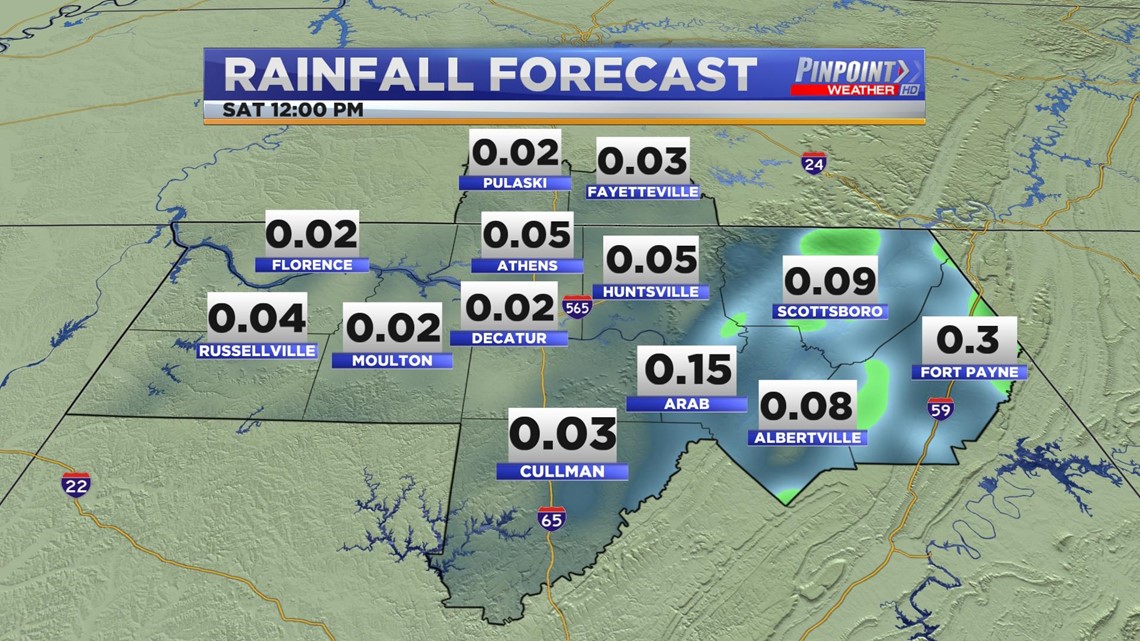
Rain totals will not amount to much. Maybe a few hundredths of an inch across the entire Tennessee Valley. Those in northeast Alabama may see slightly higher totals with higher totals still on a very local scale.

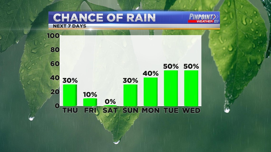
Beyond tomorrow only a small chance on Friday as the aforementioned front finally begins to move. We see a change in our weather pattern which yields a dry day on Saturday. I've included a small chance on Sunday, but most will stay dry.
Once we hit Monday and the rest of the week, there are better opportunities for showers and thunderstorms. These still look like they'll be our typical Summer showers.

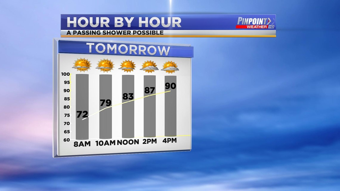
Thursday will feature temperatures similar to what we've seen the last few days. Some of us will climb into the lower 90s, but it looks like a good majority of us will hang out in the 88° or 89° range.
The mid-90s as well as the humidity will return this weekend thanks to the pattern change referenced above.