DALLAS — Severe thunderstorms happen quite frequently in North Texas, so you know not one severe thunderstorm is like the other.
This can cause issues with conveying how much of an impact one storm will have on your property.
Our WFAA meteorologists and the National Weather Services are always trying to come up with better ways to communicate the severity of a storm to you.
Starting July 28, the National Weather Service will roll out a new way to describe a severe thunderstorm. You will still get a Severe Thunderstorm Warning, but within the warning there will be a breakdown of the damage threat. This will help to distinguish between a high-impact and a low-impact event, according to the National Weather Service.
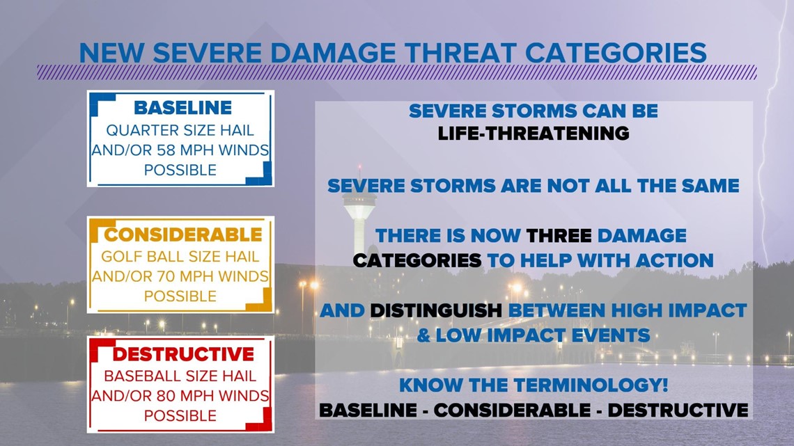
The categories are:
- Baseline
- Considerable
- Destructive
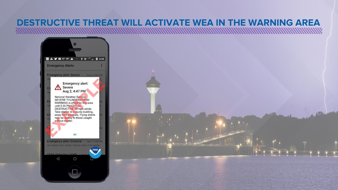
A destructive damage threat will automatically activate a Wireless Emergency Alert (WEA) on smartphones in the warned area.

What do the damage threats mean?
Baseline
This is unchanged from a normal severe thunderstorm warning. Quarter-size hail (1.00" in diameter) and/or 58 mph thunderstorm winds are associated with this level, which will not activate a WEA. When no damage threat tag is present, damage is expected to be at the base level.
Considerable
This criteria is at least golf ball-sized hail (1.75" in diameter) and/or 70 mph thunderstorm winds. This will also not activate a WEA.
Destructive
The criteria for this damage threat is baseball-sized hail (2.75" in diameter) and/or 80 mph thunderstorm winds. This is the only category that will activate the WEA on smartphones in the warned area.
The National Weather Services says, on average, only 10% of all severe thunderstorms reach the destructive category level each year, nationwide.
When you would most likely see this damage threat level would be during a damaging wind event like derechos or more intense thunderstorms like "supercell" storms that can produce some very large hail.

The reason for this change is to have a better way to convey to the public when there is an urgent need for action, according to the National Weather Service.
Make sure to know how to stay safe in a severe thunderstorm by knowing where do you go before, during and after a severe storm in your area.