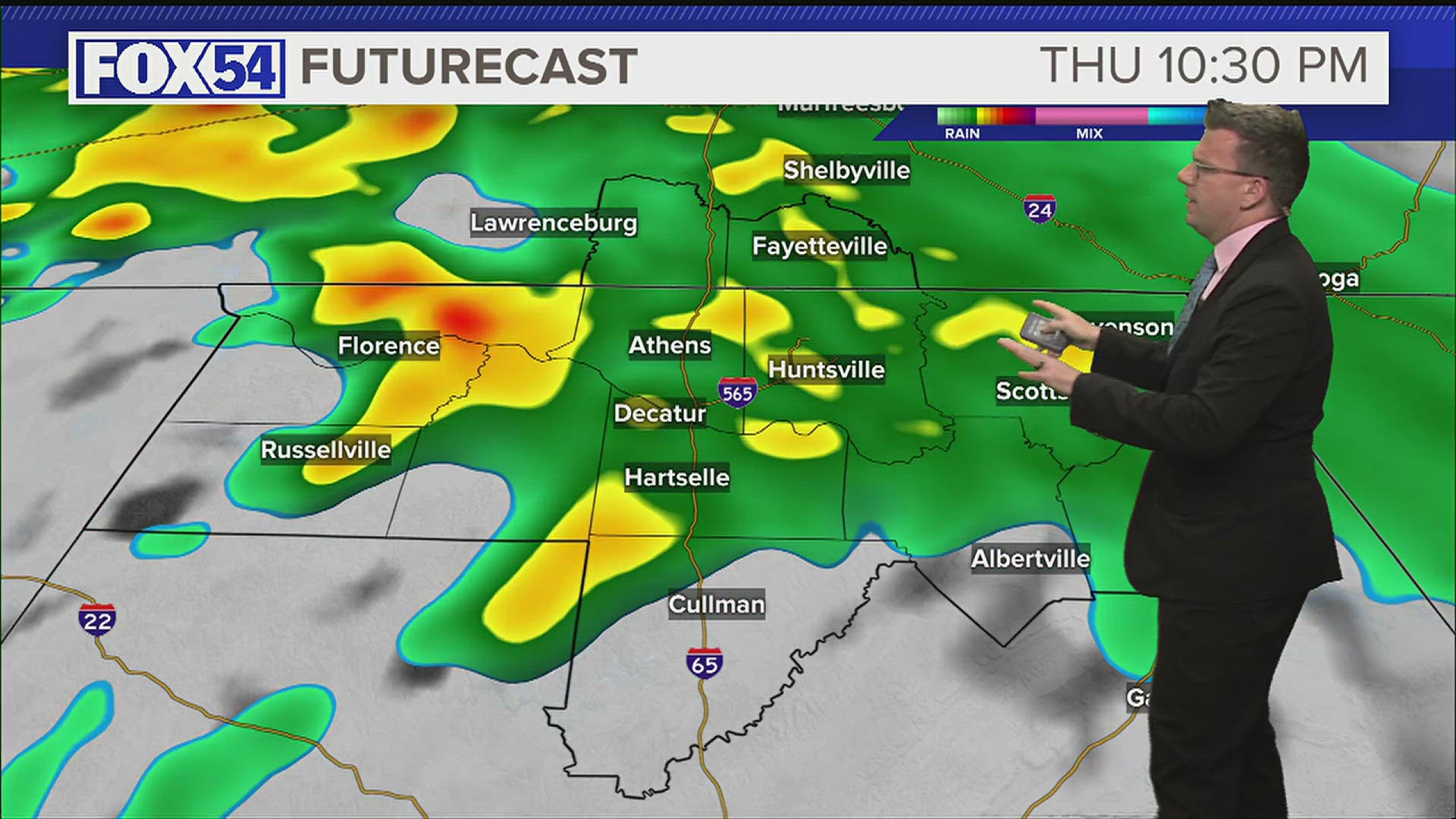
HUNTSVILLE, Ala. — A warm and humid Friday afternoon across the Tennessee Valley. Showers will end tonight, but expect some patchy fog to develop by the early hours of Saturday morning. We don't really cool off tonight, lows will only drop into the upper 60s and lower 70s.
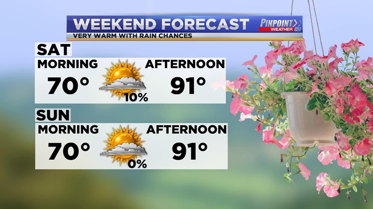
An upper-level ridge will build into the Tennessee Valley this weekend. This should keep us dry across the Tennessee Valley, but it will also keep us warm and humid. High temperatures on both Saturday and Sunday will easily climb into the upper 80s and lower 90s. It looks like Saturday could easily be the warmest day so far in 2020 across the entire Tennessee Valley.

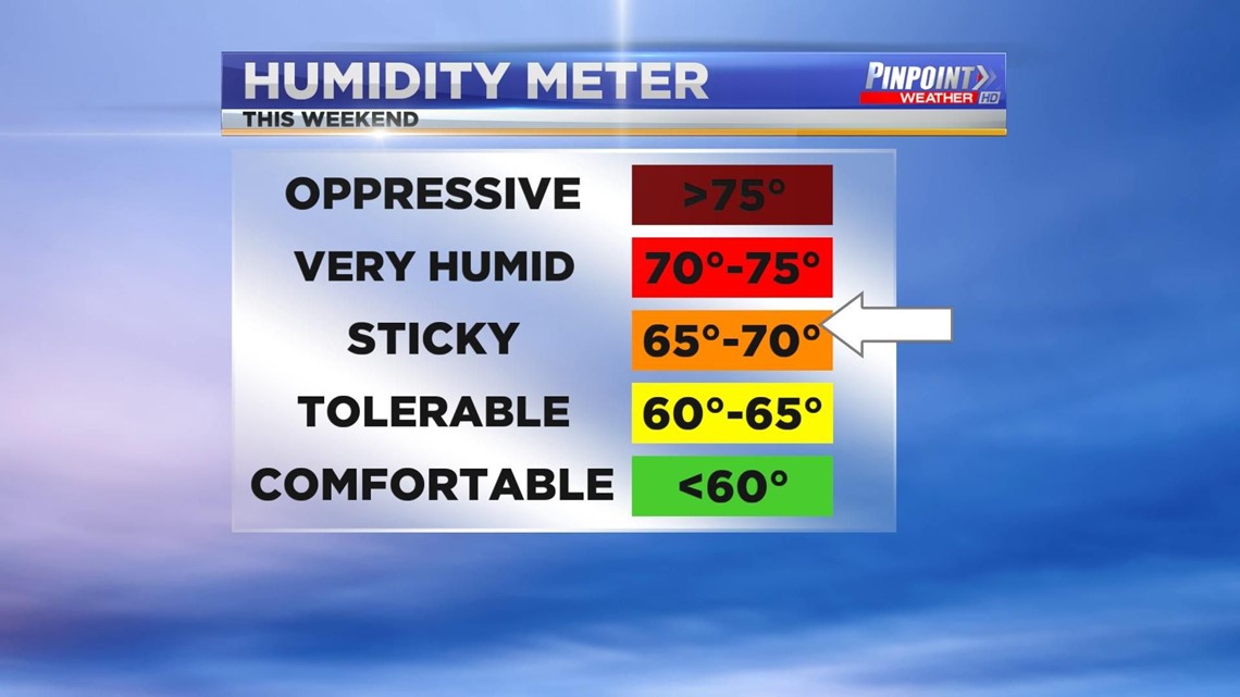
Expect heat indices to be in the mid to upper 90s. Dew points will climb into the upper 60s and lower 70s. Please be sure to have a bottle of water handy as you go about your weekend activities.
Tropical Storm Cristobal
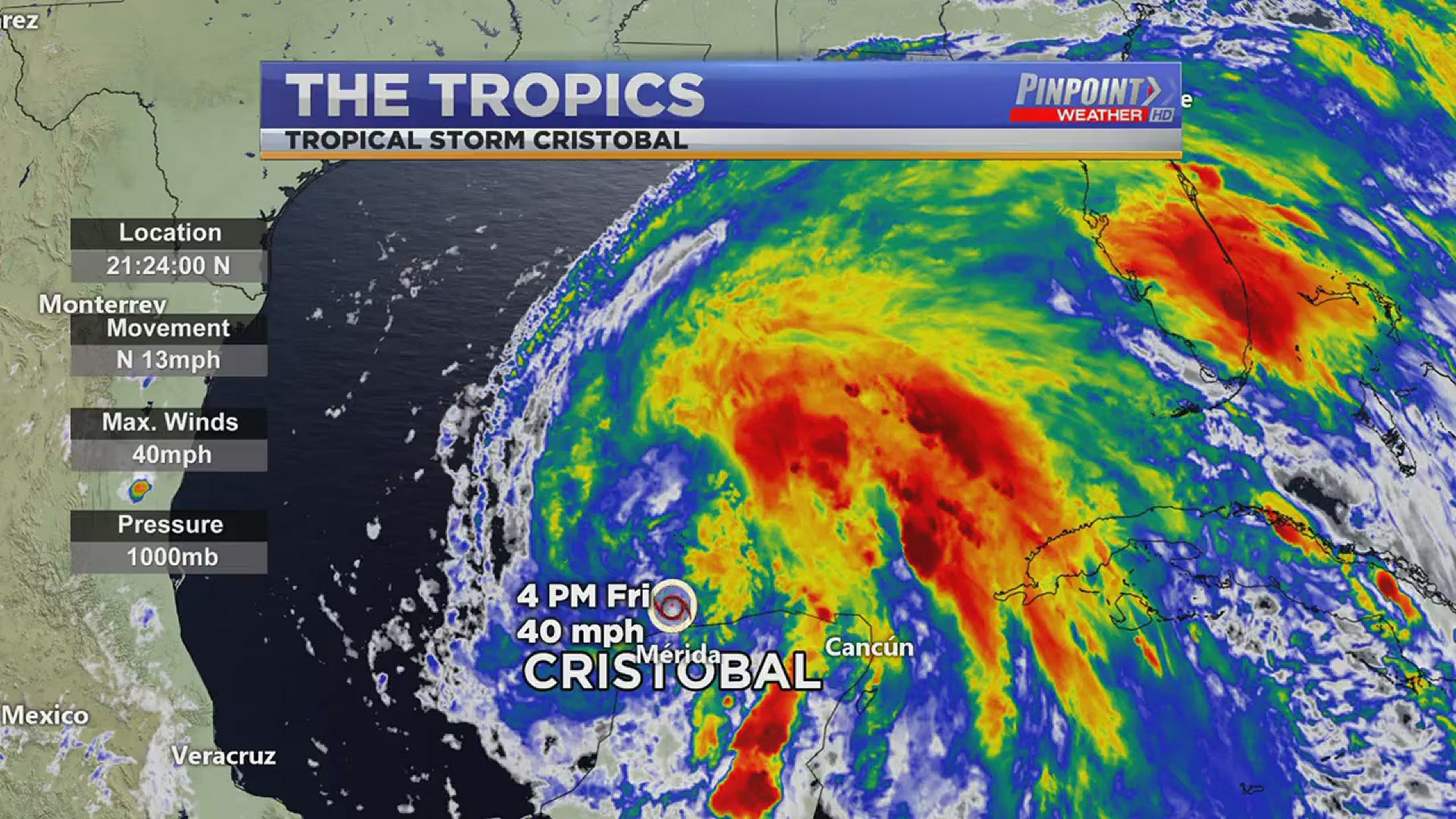
Cristobal once again strengthened into a Tropical Storm. It's also moving out of the Bay of Campeche and into the Gulf of Mexico. It'll spend the next 24 hours in the Gulf as it heads for the continental United States.
Tropical Storm Cristobal does look to make landfall late Sunday evening or Sunday night along the Louisiana Coast. From there it will continue to move north over Louisiana and Missouri. This will bring scattered showers and thunderstorms to the Tennessee Valley during the early and middle part of next week.

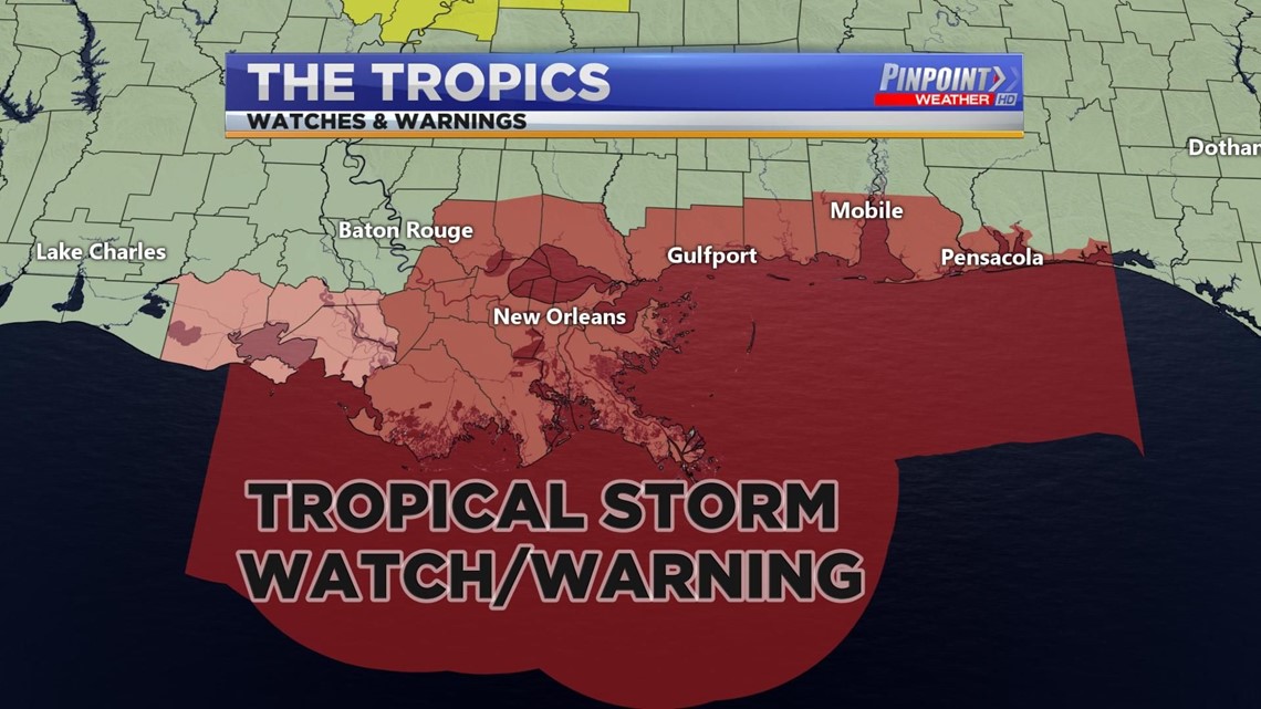
Tropical Storm watches and Warnings are currently in effect for most of the Gulf Coast from Louisiana stretching all the way to the Florida Panhandle. This includes the Alabama Gulf Coast.
Take note of gusty winds and rip current risks if you do have beach plans over the weekend.

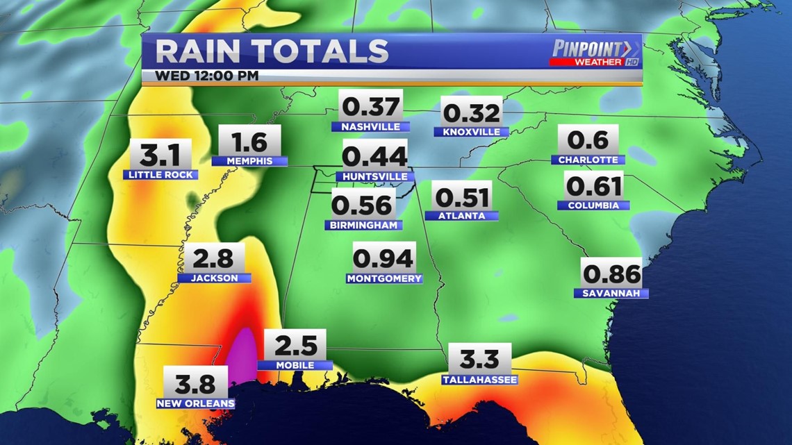
Rain totals will obviously be highest further west in Mississippi, Louisiana, Missouri, and Arkansas.