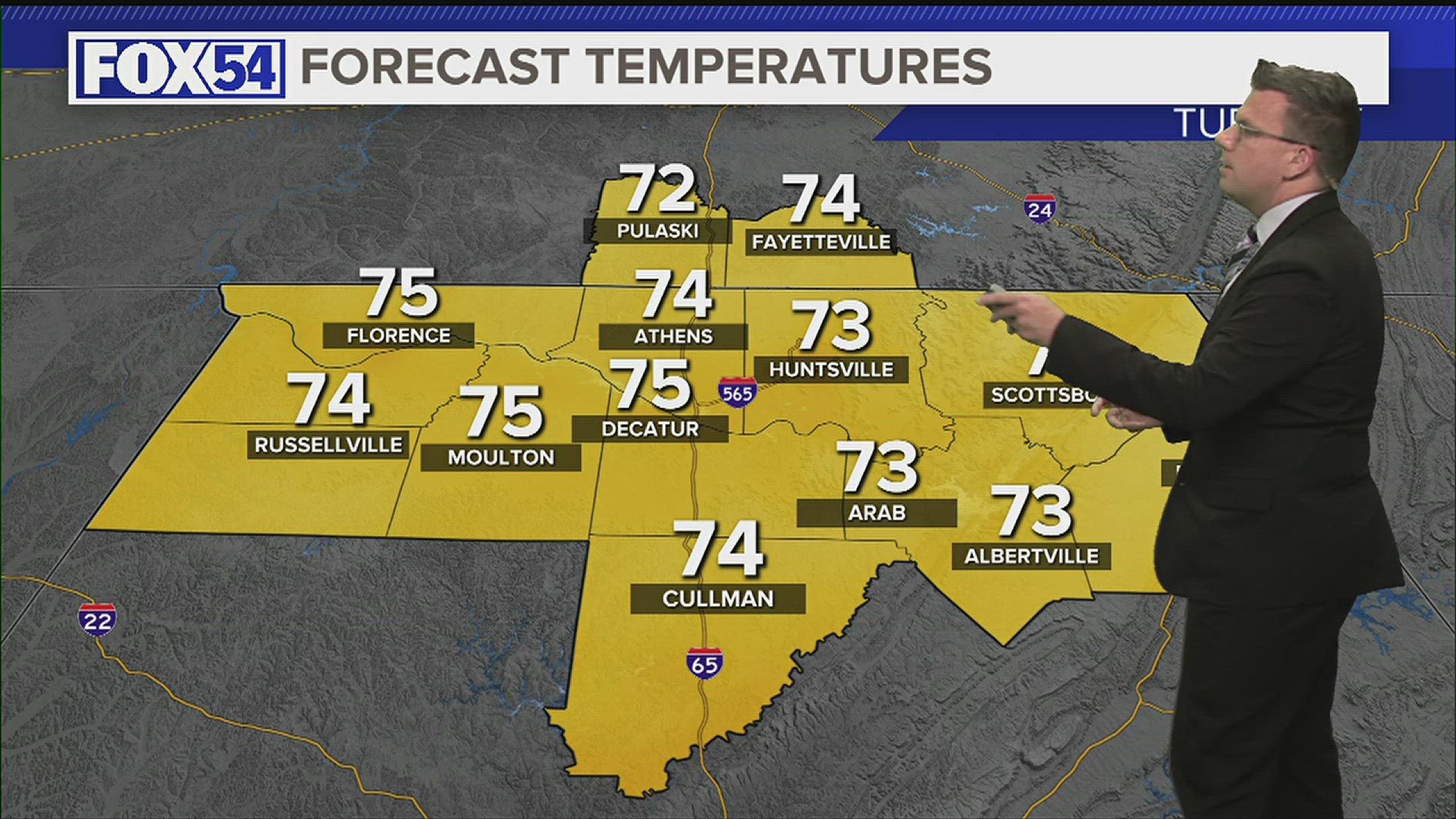
HUNTSVILLE, Ala. — It was a warm afternoon across the Tennessee Valley. Temperatures easily climbed into the low and mid-90s. Some of us saw heat indices climb into the lower triple-digits. There is some good news for us in North Alabama. There is a boundary sitting to the south that is acting as a divide between dew points in the mid-70s and dew points in the upper 60s. We're the lucky ones in this scenario.
This changes on Thursday. A frontal boundary will attempt to drop south closer to the Tennessee Valley Thursday afternoon. Ahead of this weak boundary will be some very moist air. That means the dew points in the mid-70s will creep into the Tennessee Valley.
With the front dropping southeast, the most likely places for the higher dew points will be northwest Alabama.
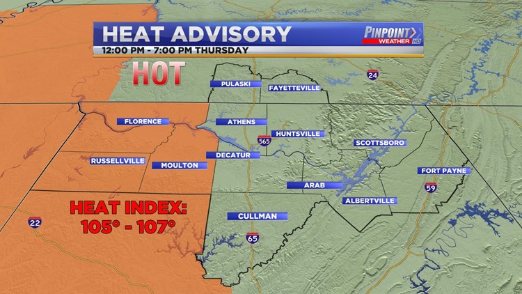
Keeping that in mind, a Heat Advisory will go into effect at 12:00 PM Thursday and run through 7:00 PM Thursday. This will be for Lauderdale, Colbert, Franklin, and Lawrence Counties.

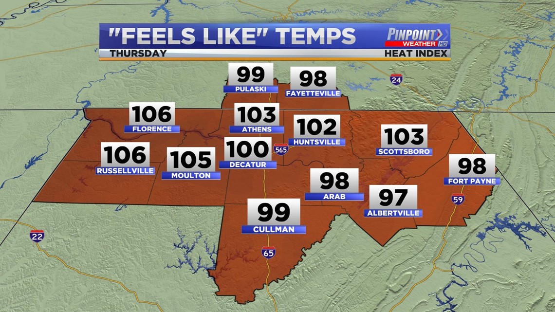
Heat Indices across northwest Alabama will easily climb to the 105° - 107° range. These numbers will be lower east of I-65.

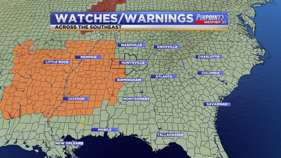
The Heat Advisory is widespread across Mississippi, Arkansas, Louisiana, and portions of Tennessee. It is also strongly correlated with the high pressure sitting west over Texas and the aforementioned front that will drop southeast.
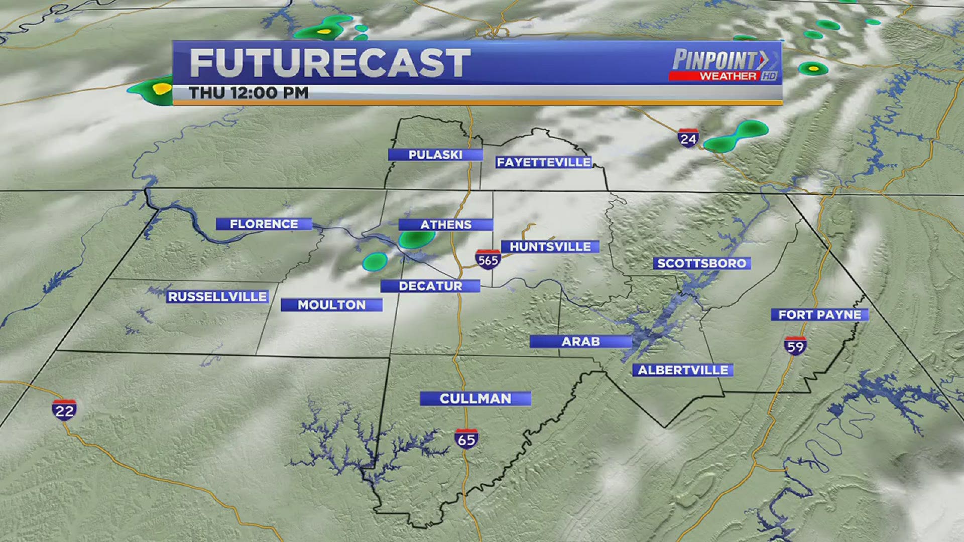
Now futurecast does bring the opportunity for a couple of showers with this front, but the best chance will come on Friday as opposed to Thursday. Friday could even come with a few thunderstorms.