HUNTSVILLE, Ala. — Thanks to an inversion it took awhile, but the clouds finally cleared late this morning and early afternoon allowing us to see some sunshine. Of course the sun really didn't do much for us because temperatures only climbed into the upper 30s and lower 40s area wide.
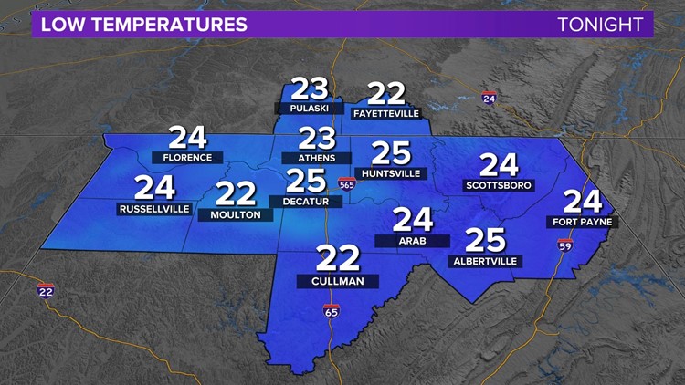
Now the clear sky will work against us. Without the blanket of clouds, excellent radiational cooling will be able to take over which means we're in for a cold night in the Tennessee Valley. When we wake up for the Wednesday morning commute we'll be in the low and mid-20s. An aver age low is right around 31 degrees or 32 degrees.

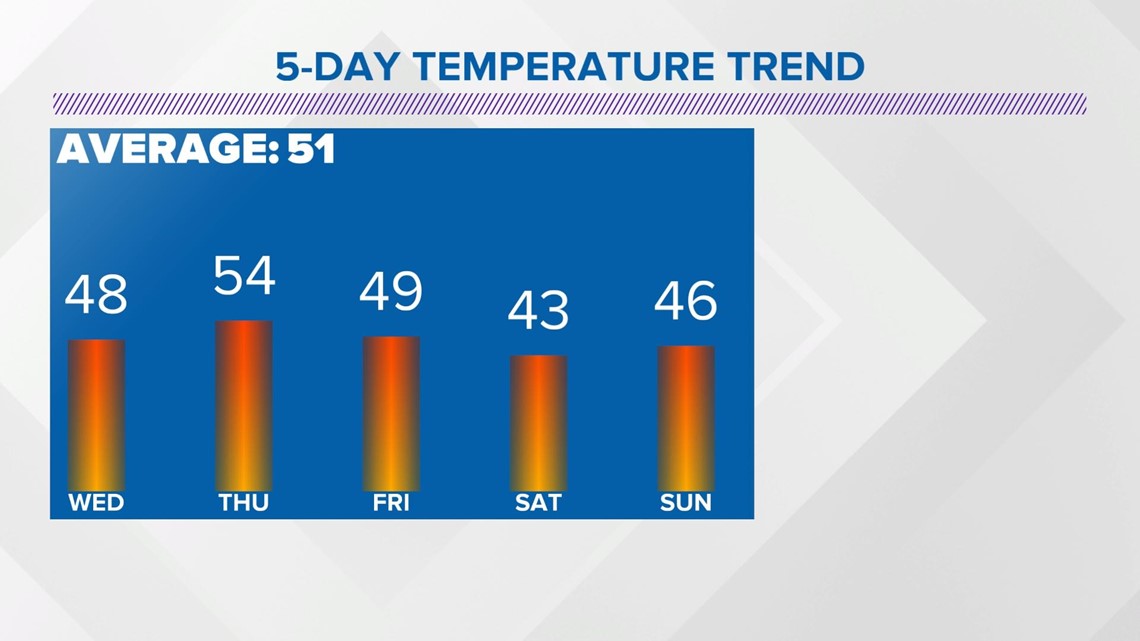
Thankfully, it looks like the coldest afternoons and nights are behind us. The temperature trend is up through at least Thursday before our next system moves through.

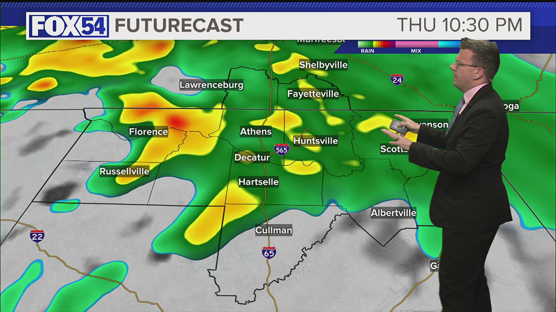
That upward swing in our temperature trend will be thanks to an area of high pressure that will move through the Gulf of Mexico allowing our winds to be somewhat southerly and our sky to remain mostly sunny. We should see some diurnally driven clouds, but no notable increase will seen until late Thursday and then a portion of Friday as a cold front moves through the Tennessee Valley.
There isn't a lot of moisture associated with this cold front, so rain really isn't something we need to mention but there is a very small chance for some rain.

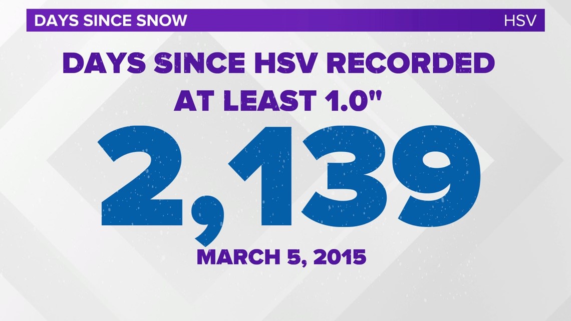
I'll leave you with a fun fact that yesterday's snow did not come to Huntsville International Airport. It has been 2,139 days since HSV has seen at least 1.0" of rain.